
Some Residents Concerned about Huge Proposed Development in Mississauga
Published July 13, 2018 at 1:31 pm
While new developments can be exciting, they can also provoke anxiety in some homeowners.
The Ninth Line lands in Mississauga have been a hot topic at the last few committee meetings at City Hall, as the planning process is now underway.
The lands themselves comprise one of the last remaining greenfields in Mississauga and there are numerous considerations involved in shaping them for the future. At the final council meeting this month, several homeowners expressed concerns regarding the ambitious plan.
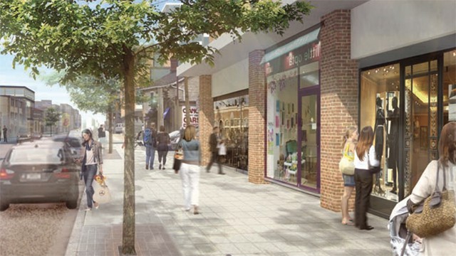
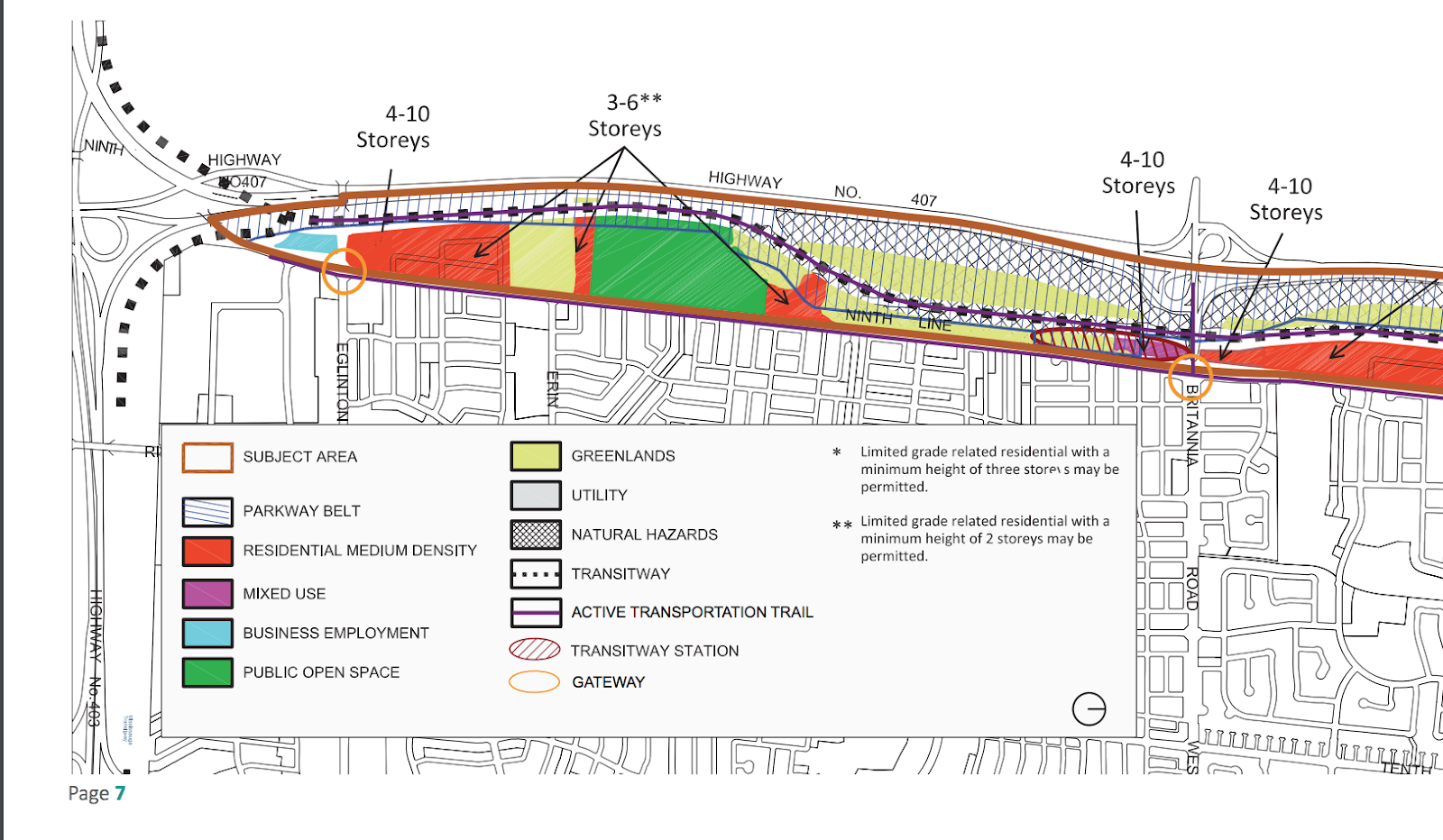
Back in June, the Planning and Development Committee endorsed a plan that outlined how the lands would be used. Some of the key components included providing mixed housing (including affordable housing), connecting the neighbourhood through trails (campus-stye), providing parks and recreation and supporting new transit lines and transportation.
For those who have not followed the story and development process of the Ninth Line Lands, there is an interactive map online here that will allow you to see the various proposed land uses.
“We want to ensure that this development is built to achieve the right density to support transit and walkable communities. Together with residents and the Region of Peel, the City has a vision to transform the Ninth Line Lands that will connect neighbourhoods and enhance communities,” says Andrew Whittemore, commissioner, Planning and Building.
Videos


As of now, most of the study area land is publicly owned and currently vacant, with the exception of 20 single detached dwellings, a few small commercial uses, St. Peter’s Mission Church, and the Enbridge/Union Gas/TransCanada Joint Operating Facility, a natural gas transmission and distribution pumping station south of Derry Road West.
In a 2017 document, the city says the area is set to become a sustainable community.
“The Ninth Line Neighbourhood is the last remaining greenfield land in Mississauga, and will be planned as sustainable, transit-supportive, connected and distinct. The Ninth Line Neighbourhood, and its six precincts, will be a model for sustainable development and a gateway into the City of Mississauga,” the document reads.
“The Neighbourhood will be designed with a focus on the importance of the natural environment, and the creation of a healthy, complete community with a sense of place. Current and future Ninth Line, Lisgar and Churchill Meadows residents will have access to a linked natural heritage system, multi-use trails, parks and open spaces. Higher-order transit, community uses and facilities and a variety of housing choices and employment opportunities will be provided to meet their needs.”
Although the development (and its potential) is exciting for some, it is posing a challenge for owners who currently live on the Ninth Line Lands. The Ninth Line neighbourhood is made up of about 350 hectares (865 acres) and private lands are interspersed in between both city and provincially owned lands.
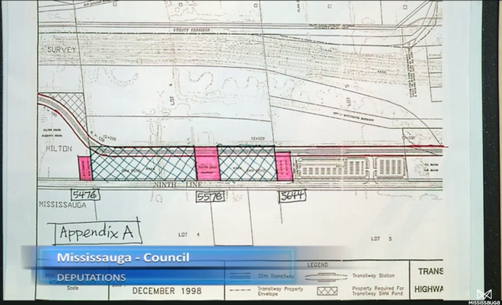
Peter Skira, one of the homeowners and the chair of the Ninth Line Property Owners Association, spoke out about how the plans to put the 407 transitway line affected his rights to use his lands. See the below proposed transitway indicated with a dotted line.
“I’m still calling it the unapproved, proposed 407 Transitway line alignment…that proposed alignment is still cutting through my lands. The proposed zoning seems to be adding this extra 30 meters and 14 meter buffer past what is the amendment ninety-one line. We feel that is infringing on our development rights that we currently have.”
The story of the parcel in question goes back to 2010, when the lands were initially part of the Town of Milton. They were later annexed to be part of the City of Mississauga. In the past, homeowners were told that if they agreed to be part of Mississauga, there would be better benefits for them and they would receive support from the city. Becoming part of Mississauga, however, meant a tax increase of 16 per cent for the homeowners, as well as additional costs and expenses.
Skira references a memorandum of understanding from 2009 between Mississauga/Peel and Milton/Halton as part of the annexation process that indicates that parties agreed that development rights attached to the subject lands shall not be negatively impacted by a boundary realignment.
The City of Mississauga and the Region of Peel partnered with the Ministry of Transportation to conduct a study of the 407 Transitway alignment. There may be more answers for homeowners and the public going forward at future meetings.
Another large issue that is affecting the owners and the development is that the lands are located in the floodplain. Most of the lands have been approved for development, but smaller parcels of land (1 acre for example) that is owned by a resident have not been approved for development. Smaller land owners have also not been provided with resources and support on how to develop the lands.
Residents mentioned that they were not included in various studies of the flood plain and as such have had to seek outside, costly resources to look at land use potential.
“Again, why am I left to fight for designation, how do you leave this land undeveloped? It makes no sense,” said a Mississauga resident at the meeting.
“I do think that those of you with the small land have been very poorly treated, and you should have been able to develop your land and I’ve said that to staff quite a few times…So I’m not surprised that you’re here today…more should have been done to make sure that you had some developable land,” said Councillor Pat Saito of Ward 9.
The process is just unfolding as studies and discussions with the public continue.
There will be more updates to follow this year.
insauga's Editorial Standards and Policies advertising