
The cooler, unseasonable weather is hanging on this weekend in southern Ontario.
After some brief bursts of warm weather, the temperature dropped again this week. Cold weather led to frost alerts issued in the Greater Toronto Area.
While temperatures will reach spring-like highs, the evening lows continue to be cool throughout the weekend.
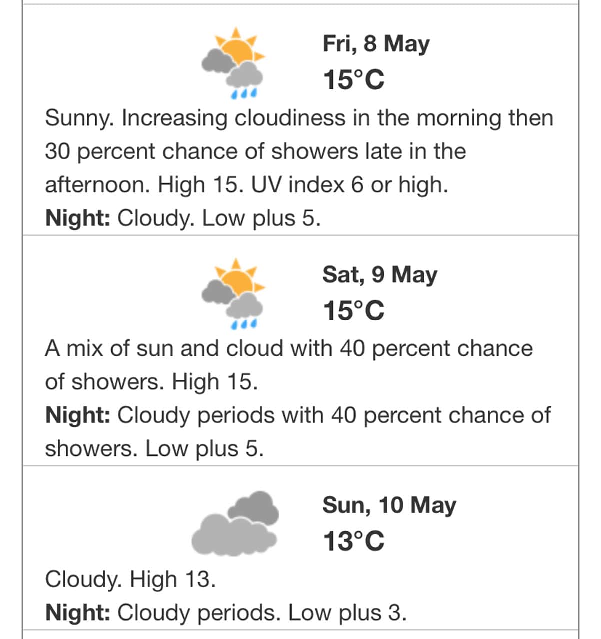
On Friday, a high of around 15 C is expected with a 30 per cent chance of showers in Toronto, Mississauga, Brampton, Burlington, Oakville, Hamilton and Durham Region, according to Environment and Climate Change Canada.
A low of 5 C is forecast for Friday night.
Saturday could start off cool with a high of 7 C expected in the morning, according to the Weather Network. But it will warm up to around 16 C by the afternoon, then drop down to 5 C in the evening.
There is a 40 per cent chance of rain on Saturday with a risk of a thunderstorm in the afternoon.
The sun could peek out during the day.
Sunday looks to be mainly cloudy with a high of 13 C and a chilly low of 3 C in the evening.
Normal temperatures for this time of year are highs of 17 C and lows of 6 C, according to Environment Canada.
Lead photo: Nataly Nagorska
PollView All
WIN A $100 GIFT CARD
Subscribe to INsauga’s daily email newsletter for a chance to win a $100 Amazon gift card.