
Some Snow in the Forecast for Mississauga
Published April 8, 2019 at 8:05 pm

Today might be absolutely gorgeous by early spring standards, but the party won’t last for too much longer.
While the forecast isn’t terrible–it certainly doesn’t look a blizzard or ice storm is on route–The Weather Network says Old Man Winter isn’t quite finished with Ontario overall just yet.
“The winter-spring battle persists across Ontario all week and it looks like winter will continue to take the upper hand,” the Weather Network said in a recent article.
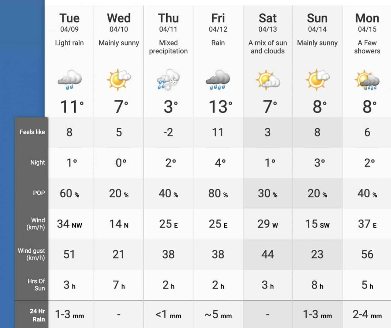
The weather organization says that, by mid-week, much of the province will turn wintry, with widespread cooler temperatures and a “messy mix of wet snow.”
The Weather Network also says that a cooler pattern will likely persist over the coming weeks.
Videos


According to the forecast, the double-digit temperatures we’re currently enjoying will dip as the week goes on. On Thursday, we’ll see a high of 3 degrees and mixed precipitation (that means a little snow).
“This track will bring milder weather into our region and spare southern Ontario from seeing a winter-like storm,” says Weather Network meteorologist Dr. Doug Gillham in the article.
“However, as the warm front lifts north towards and eventually through our region on Thursday, we will have a brief period of wet snow that will change to rain and a raw east wind off of Lake Ontario.”
Friday will see temperatures climb up to a more pleasant 13 degrees and the weekend will be a little on the chilly side, with temperatures hovering in the high single digits.
insauga's Editorial Standards and Policies advertising