
Heavy snow and what can best be described as a potentially dangerous and messy wintry mix are in the forecast for southern Ontario as a mid-week storm appears to be bearing down on the area.
Weather officials note that the heavy snow will stay more to the north while prolonged periods of freezing rain and rain are possible in areas across southern Ontario starting Wednesday afternoon and lasting into the evening and Thursday as well.
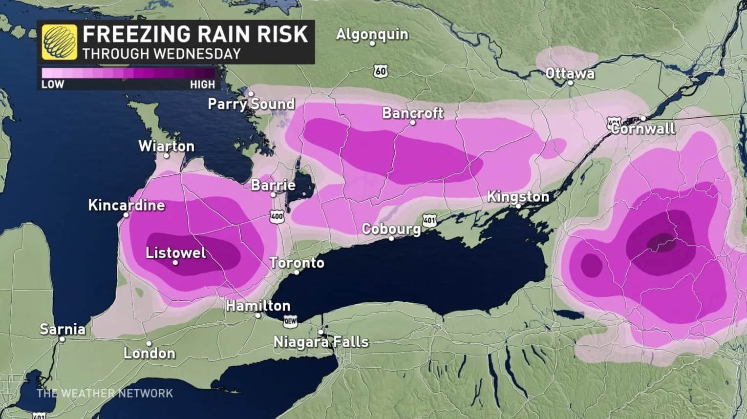
Officials at The Weather Network said online that the developing storm could “grow into a sprawling disruption for much of the province” with dangerous driving conditions and power outages possible as well in parts of southern and eastern Ontario.
Forecasters say a Colorado low pressure system will likely join up with an incoming weak Alberta clipper over the Great Lakes to produce the messy weather.
Drivers are urged to plan trips accordingly and if on the roads to drive slowly and according to the conditions.
Exact location of the expected icy weather ingredients continues to fluctuate given the uncertainty surrounding which of the weather systems will prove more dominant, forecasters say.
However, weather officials add there is a degree of confidence that a “stagnant area of freezing rain and ice pellets” will set up between Barrie and Ottawa.
Areas throughout much of the Golden Horseshoe including Mississauga, Brampton, Toronto, Burlington, Oakville and Hamilton can expect to see mostly rain, but freezing rain is possible Wednesday evening and night as temperatures drop to near freezing, weather officials say.
(The Weather Network)
INsauga's Editorial Standards and PoliciesPollView All
WIN A $100 GIFT CARD
Subscribe to INsauga’s daily email newsletter for a chance to win a $100 Amazon gift card.