
There could be some active weather in southern Ontario over the next few days.
Weather outlooks from Environment Canada say there’s a risk of thunderstorms and “significant” rain in parts of the region.
Here is a look at what’s expected:
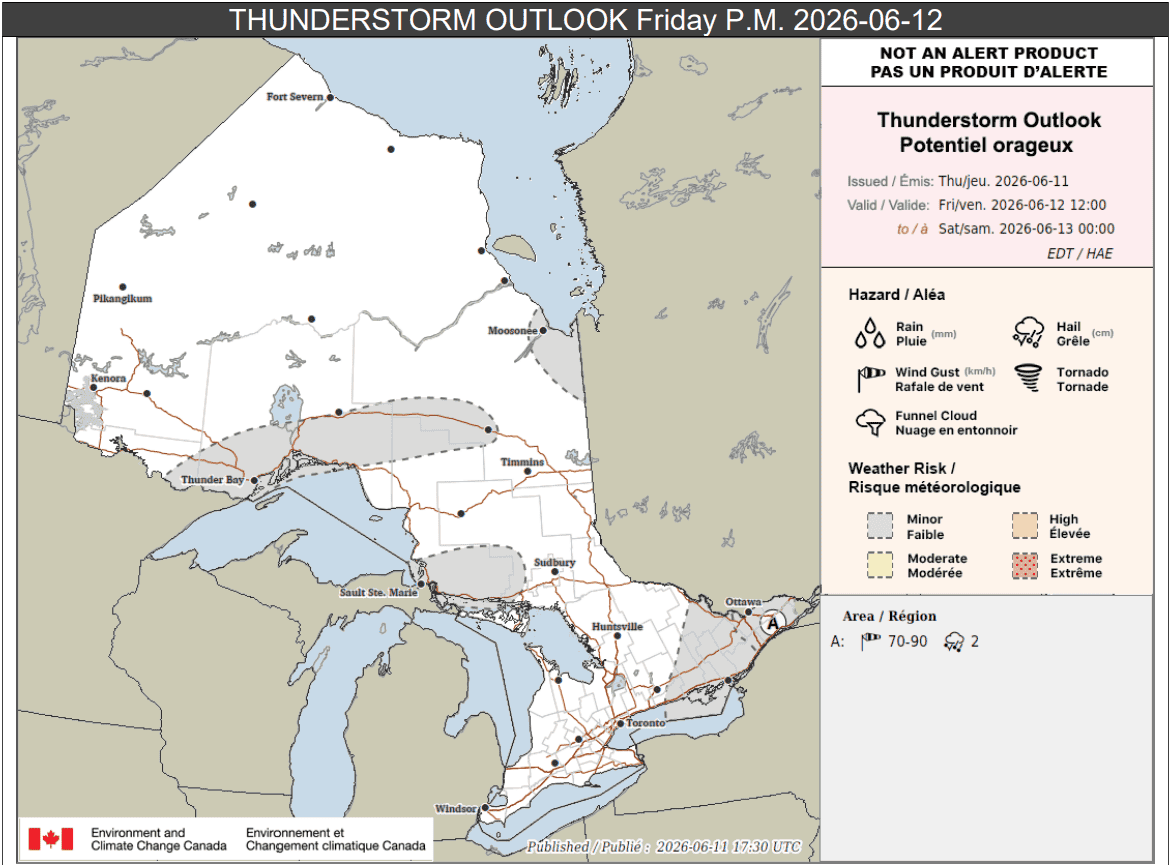
Friday p.m.
Portions of eastern Ontario, including Prince Edward County, Kingston, and Ottawa (location A on the map below), could see rain in the afternoon and evening on Friday.
“A broken line of showers and thunderstorms may develop and move eastward through eastern Ontario in the afternoon. Marginally severe wind gusts of 70 to 90 km/h and 2 cm hail are possible with some storms,” forecasters said.
Up to 15 mm of rain may fall locally.
Elsewhere in the province, areas highlighted in grey including Sault Ste. Marie and Thunder Bay, could see isolated thunderstorms in the afternoon, which could drop 25 mm of rain.
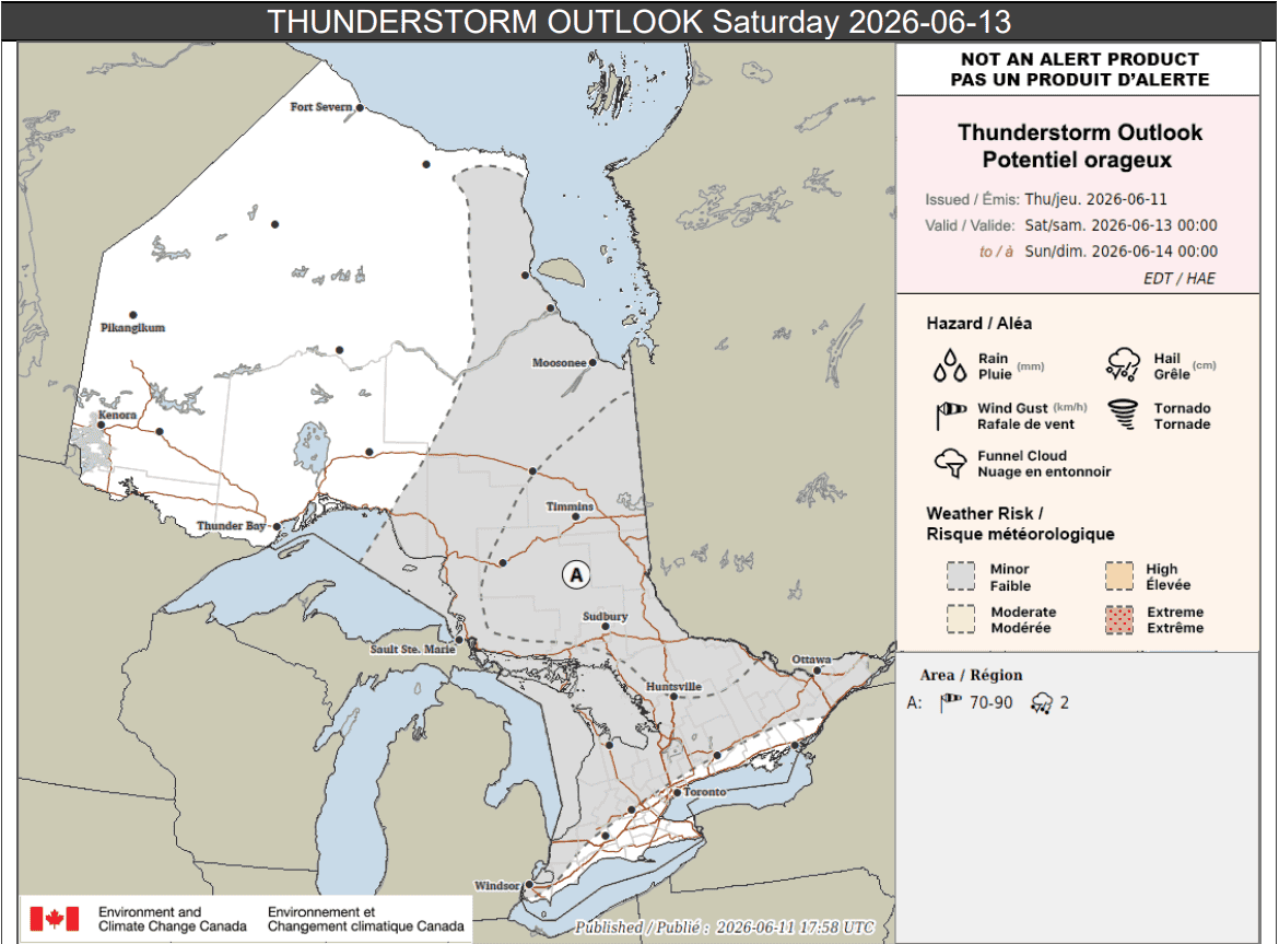
Saturday
On Saturday, the risk for thunderstorms is more widespread.
Portions of southern and northeastern Ontario highlighted in grey on the map below may see isolated thunderstorms which could bring 20 mm of rain.
Areas labelled location A, which includes Sudbury and Timmins, could see scattered storms in the afternoon and evening that bring strong wind gusts up to 90 km/h and 2 cm hail. Up to 30 mm of rain could fall there.
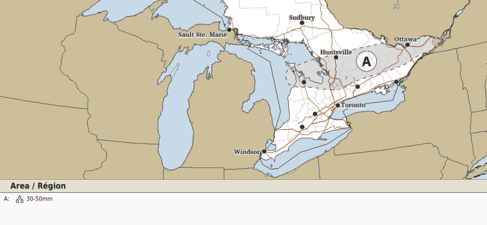
Sunday
Sunday is when there is a risk of “significant” rainfall in parts of southern Ontario, including the Bruce Peninsula, parts of cottage country, east to Ottawa.
“A low-pressure system may bring significant amounts of rainfall to central and eastern Ontario on Sunday,” Environment Canada said.
“Current numerical guidance suggests that 30 to 50 mm of rain is possible, but uncertainty is very high on the exact locations and amounts at the moment.”
Environment Canada said predictability was still too low to create a thunderstorm outlook for Sunday.
Maps via Environment Canada
PollView All
WIN A $100 GIFT CARD
Subscribe to INsauga’s daily email newsletter for a chance to win a $100 Amazon gift card.