
There is a risk of severe thunderstorms in parts of southern Ontario amid a multi-day heat wave in the region.
Environment Canada has published outlooks for the next few days, with significant weather expected.
Portions of southern Ontario, including the Barrie area and the Bruce Peninsula, have a risk of isolated thunderstorms Monday afternoon and evening.
On Tuesday, however, there is a more widespread risk of storms.
READ MORE: Heat warning issued for parts of southern Ontario
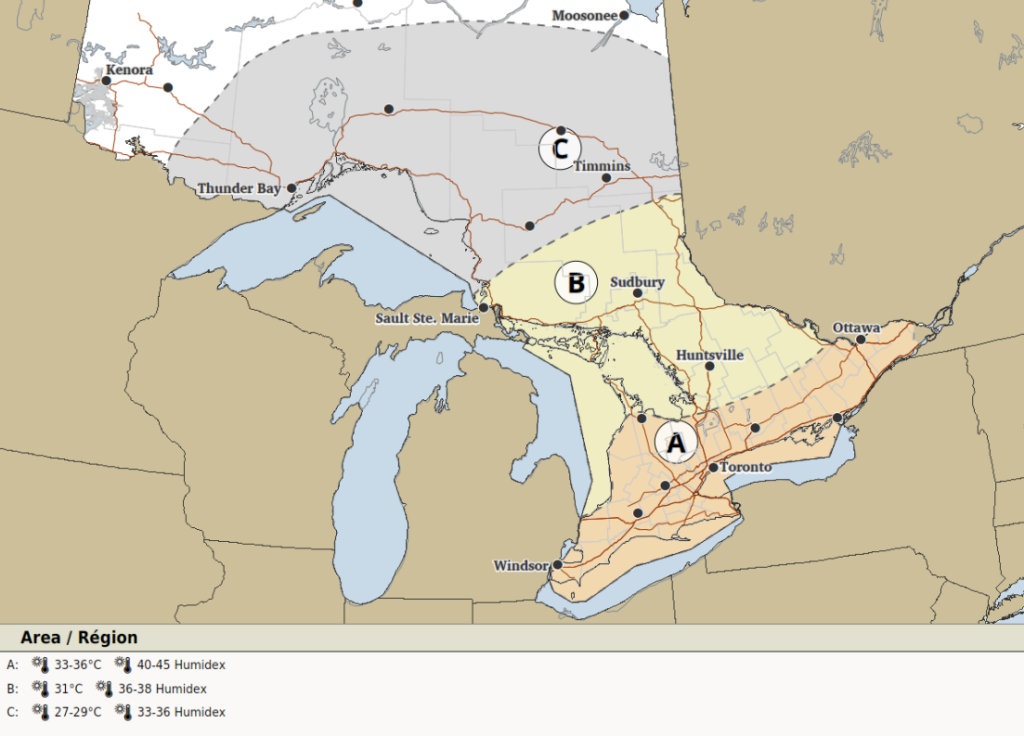
“An area of severe thunderstorms may track through the area on Tuesday from northwest to southeast,” forecasters said for areas labelled location A on the thunderstorm outlook below. That includes eastern parts of the region, including Prince Edward County, Kingston, and Ottawa.
“There remains large uncertainty for the development and timing of these storms. Very strong wind gusts, large hail and a risk of a tornado would all be threats.”
Up to 50 mm of rain is possible locally with a peak hourly amount of 30 to 50 mm.
Loose objects could be tossed, weak buildings could be damaged, and trees may be downed.
Power outages could also occur.
Areas labelled location B on the thunderstorm outlook, which includes portions of northern Ontario, face a risk of severe storms as well.
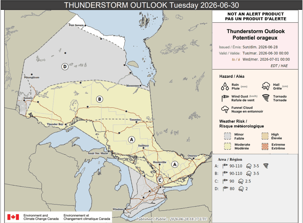
Parts of southern Ontario southeast of Georgian Bay (location C on the thunderstorm outlook), may also see severe storms, but there is still uncertainty in the forecast.
“Severe thunderstorms may develop with strong wind gusts and hail being the main threats. Confidence remains low for the likelihood that these storms will even develop across this region,” Environment Canada said for those areas.
Up to 30 mm of rain is possible there locally.
The rest of southern Ontario (highlighted in grey on the map) may see storms as well, but “confidence remains very low.”
That includes parts of the Greater Toronto Area, Hamilton, Niagara Region, London, and Windsor.
Environment Canada said “the odd isolated thunderstorm may be possible” with up to 30 mm of rain locally.
Meanwhile, portions of far northern Ontario (location D on the outlook), may see strong thunderstorms on Tuesday too.
Very hot temperatures expected
As mentioned, very hot conditions are expected throughout the week in southern Ontario.
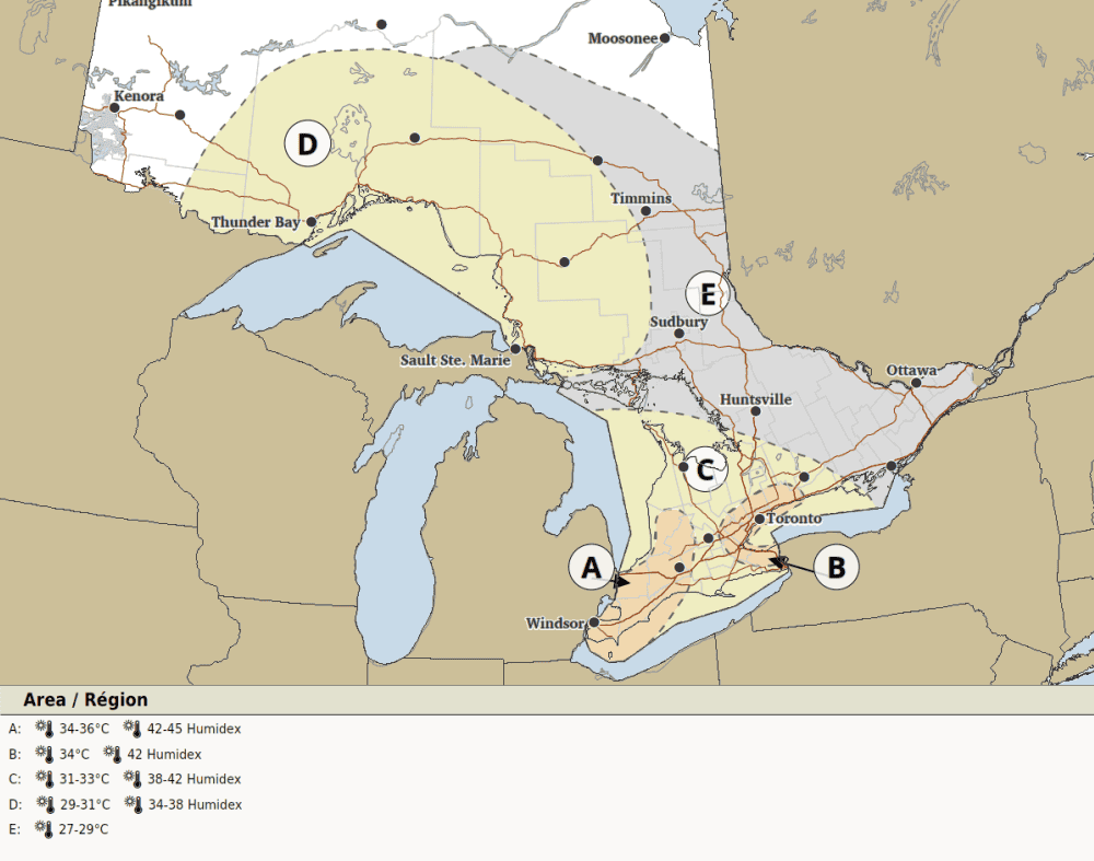
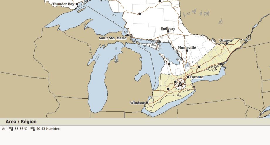
On Tuesday, a high of 34 C is expected in much of the GTA with a humidex value of 42.
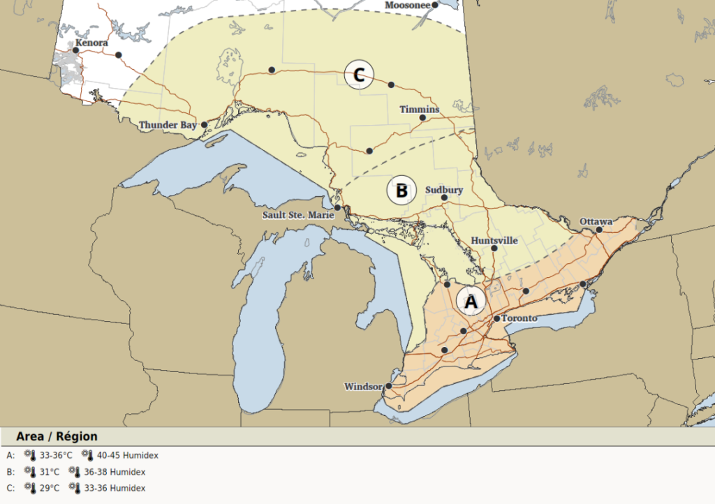
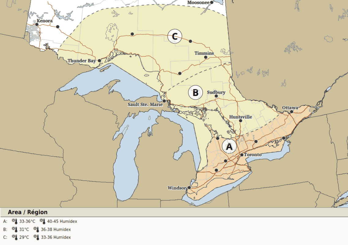
On Wednesday and Thursday, it will be 33 C to 36 C in most of the southern Ontario, with a humidex of 40 to 45.
Environment Canada said predictability was still too low to create thunderstorm outlooks for Wednesday and Thursday.
-
- Tuesday
-
- Wednesday
-
- Thursday

-
- Friday
Maps via Environment Canada
INsauga's Editorial Standards and PoliciesPollView All
WIN A $100 GIFT CARD
Subscribe to INsauga’s daily email newsletter for a chance to win a $100 Amazon gift card.