
Heat and humidity have dominated this summer in southern Ontario, but will that hot weather continue into the fall?
There have been repeated heat warnings this summer in the Greater Toronto Area. Heat events started in June and continued into July — the latest multi-day heat wave just ended this week.
Fall officially starts on Sept. 22, but temperatures typically start to cool after Labour Day weekend.
The latest predictions, however, suggest warmer-than-average temperatures may continue in August and into the fall.
After a brief cooling period, “warmer-than-normal temperatures” are expected to dominate, with a few cool days, in the last half of August in Ontario, according to the Weather Network.
In August, the average temperature high is around 27 C and the average low around 16 C, according to Time and Date. Temperatures gradually lower to an average high of 23 C and low of 12 C in September, and an average high of 15 C and low of 6 C in October.
But this year, it could be slightly warmer than average in September and October.
August, September, and October could see above-normal temperatures in Ontario and Eastern Canada, according to Environment Canada’s seasonal prediction system.
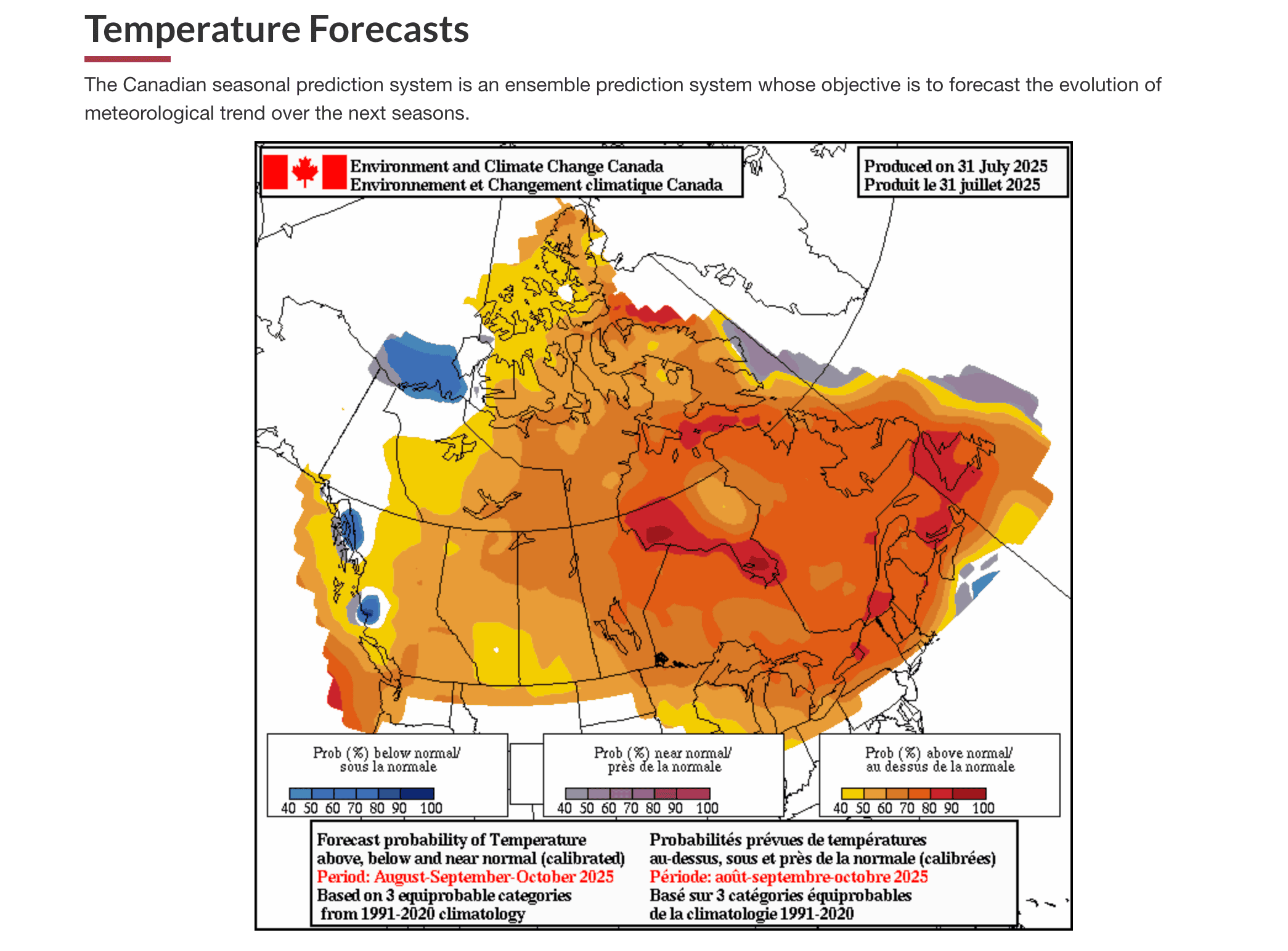
Areas shaded in orange, red and yellow could see higher-than-normal temperatures in September and October.
At the same time, the Farmer’s Almanac, predicts a “cooler than normal” September and October in southern Ontario. Precipitation is greater than normal in the north and less than normal in the south, the Almanac predicts.
However, it’s important to note that the Almanac is not based on meteorology. And their 2023-4 accuracy rate in forecasting “the direction of temperature departure for a representative city in each region was 44.4 per cent.”
Lead photo: Alex
INsauga's Editorial Standards and PoliciesPollView All
WIN A $100 GIFT CARD
Subscribe to INsauga’s daily email newsletter for a chance to win a $100 Amazon gift card.