

Widespread thunderstorms are expected to hit southern Ontario.
Environment Canada says the active weather is expected in the region on Tuesday.
“Strong wind gusts and heavy rain are the primary threats and hail is also possible,” forecasters said for location B on the map below, which covers most of southern Ontario.
That includes Ottawa, Kingston, Prince Edward County, the Greater Toronto Area, Hamilton, Niagara Region, London, and Windsor.
Wind gusts could reach 80 km/h.
There could be broken tree branches, downed trees, and power outages.
Up to 40 mm of rain could fall, with a peak local hourly amount of up to 30 mm.
Further north, for location A on the map, which includes the Bruce Peninsula and much of cottage country, storms are also expected.
Strong winds up to 90 km/h and heavy rain will be the main threats there.
Up to 50 mm of rain could fall locally with a peak local hourly amount of up to 40 mm.
In both cases, Environment Canada said timing will affect how strong the thunderstorms may become.
Other areas shaded in grey on the map, which is a large part of northern Ontario including Sault Ste. Marie, Timmins, Thunder Bay and Moosonee, could also see active weather.
-
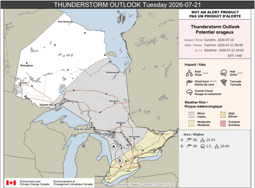
- Credit: Environment Canada
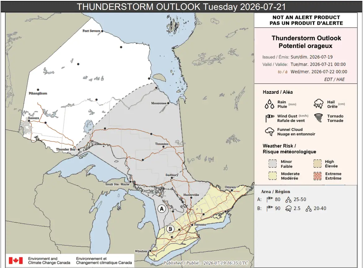
“Isolated thunderstorms are possible within a large area of showers associated with a low pressure system,” forecasters said for those areas.
Up to 30 mm of rain is possible locally.
Meanwhile, parts of northern Ontario are also expected to see impacts from wildfire smoke over the next couple of days, with poor air quality in the forecast.
PollView All
WIN A $100 GIFT CARD
Subscribe to INsauga’s daily email newsletter for a chance to win a $100 Amazon gift card.