
Multiple weather alerts, warnings and watches are on across southern Ontario with strong winds gusting up to 80 km/h, heavy snow and a possibility of power outages.
Environment Canada says strong winds are expected to pick up into the evening hours in areas north, south and east of Toronto with speeds up to 80 km/h in Niagara Falls, St. Catharines, Orillia, Barrie, Collingwood, Quinte West, Prince Edward County, Northern Huron County and other areas.
Southwesterly winds will shift to strong northwesterly winds on Thursday night in the wake of a cold front, and the agency says loose objects may be tossed by the wind and cause injury or damage.
Power outages may also occur, Environment Canada says.
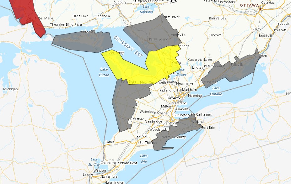
North of the GTA a snow squall watch was upgraded to a warning around 6:45 p.m. with lake effect snow expected to dump between 15 and 25 cm in communities near Georgian Bay. The snow is expected to continue into Friday afternoon.
Other areas could see “brief” bursts of heavy snow with peak snowfall of 2 to 4 cm per hour possible.
Looking ahead to the weekend and a low system tracking across the lower Great Lakes area could bring significant weather. Between 10 to 15 cm of snow could fall through the weekend to the GTA, Environment Canada says.
PollView All
WIN A $100 GIFT CARD
Subscribe to INsauga’s daily email newsletter for a chance to win a $100 Amazon gift card.