
Thunderstorms with strong winds and hail could hit parts of southern Ontario on Thursday.
Environment Canada has issued thunderstorm outlooks detailing what’s in the forecast.
Here’s a look at what’s expected:
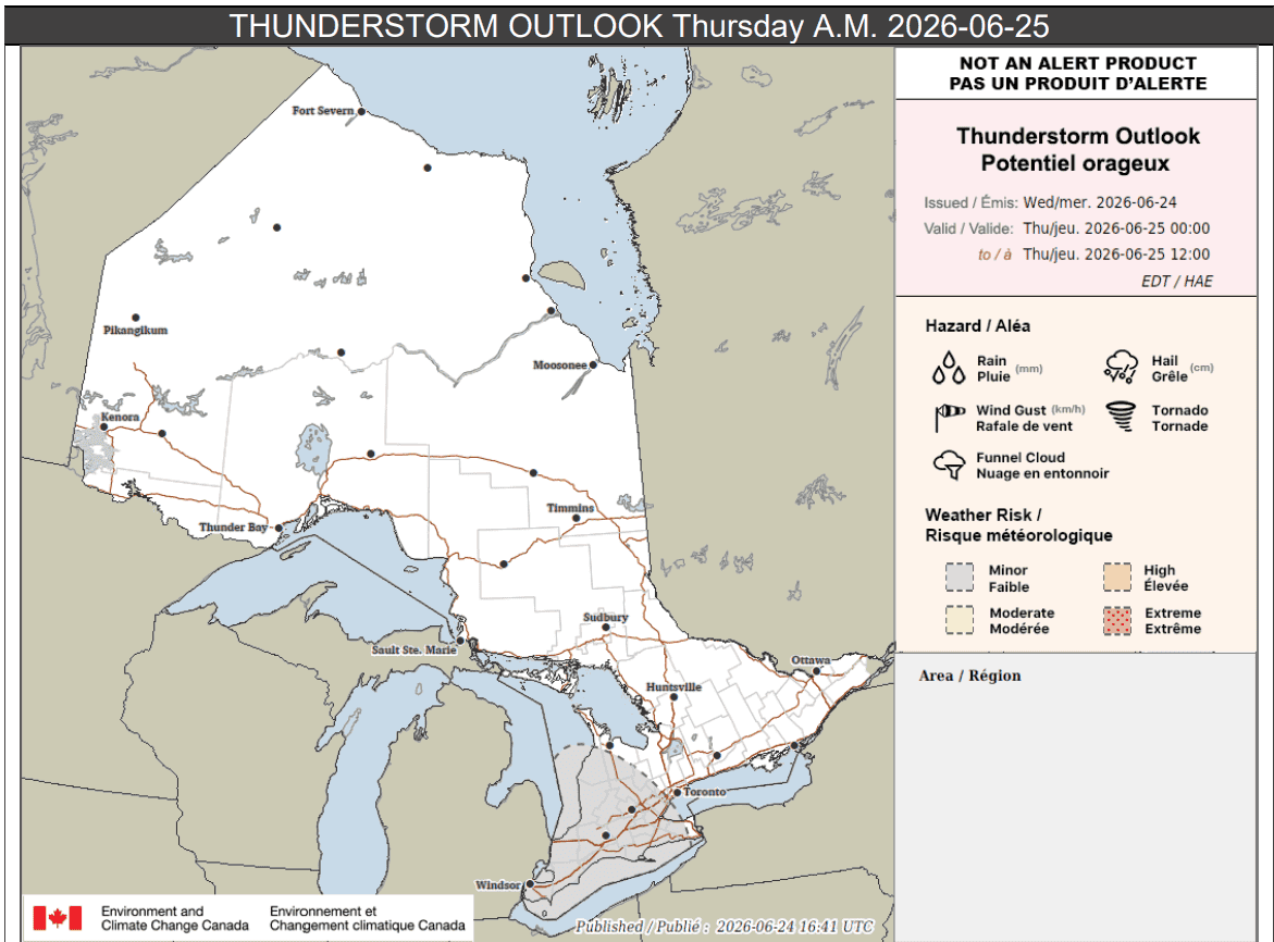
Thursday a.m.
Parts of southern Ontario (shaded in grey below) may see isolated thunderstorms overnight into Thursday morning.
Isolated lightning strikes are possible.
Up to 20 mm of rain may fall locally, with a peak hourly amount of up to 15 mm.
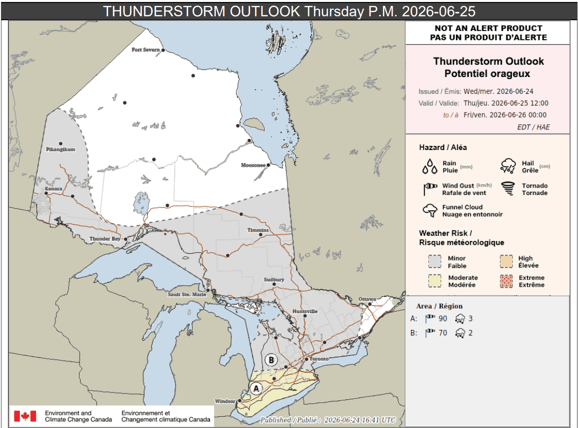
Thursday p.m.
During the afternoon and evening, there is a risk of more severe storms.
“A few thunderstorms capable of producing wind gusts up to 90 km/h and hail up to 3 cm are possible,” forecasters said for areas labelled location A and highlighted in yellow on the map below.
That includes portions of southwestern Ontario and the Greater Golden Horseshoe, including Hamilton, the Niagara Region and Windsor.
Up to 30 mm of rain is possible locally with a peak hourly amount of up to 30 mm.
Loose objects will likely be tossed around and property damage could occur in storms, forecasters said.
Other portions of southwestern Ontario and the Greater Golden Horseshoe, including Toronto, could see scattered thunderstorms (location B on the map).
Those storms could produce wind gusts up to 70 km/h and hail up to 2 cm.
Up to 15 mm of rain could fall locally.
Other areas on the map highlighted in grey, which includes parts of southern, northeastern, and northwestern Ontario, could see isolated thunderstorms that drop less than 15 mm of rain locally.
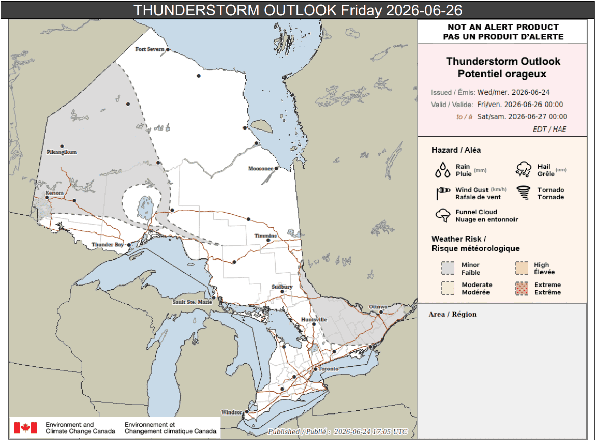
Friday
There is also a risk of thunderstorms in parts of Ontario on Friday.
Portions of eastern Ontario could see up to 15 mm of rain, while parts of northwestern Ontario and some areas north of Lake Superior could see less than 15 mm locally.
Maps via Environment Canada
PollView All
WIN A $100 GIFT CARD
Subscribe to INsauga’s daily email newsletter for a chance to win a $100 Amazon gift card.