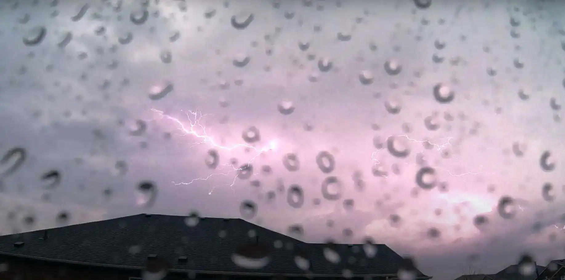
A risk of thunderstorms continues for parts of Ontario amid a heat wave.
Some storms could be severe, bringing a threat of strong winds, large hail, and a risk of a tornado.
Here’s a look at what’s expected over the next couple of days, according to Environment Canada:
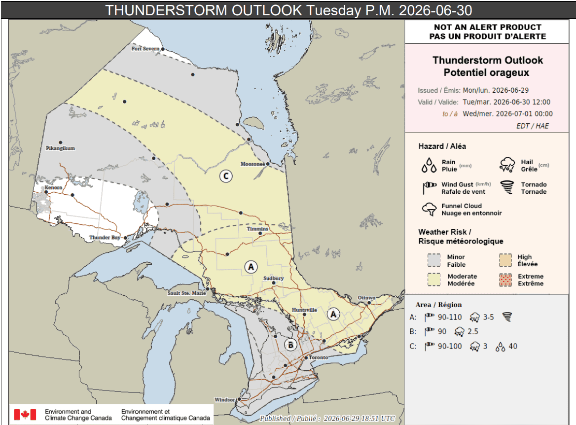
Tuesday p.m.
Parts of northeastern, central, and eastern Ontario (location A on the thunderstorm outlook below), could see an area of severe storms that moves from northwest to southeast.
“There remains large uncertainty for the development and timing of these storms. Very strong wind gusts, large hail and a risk of a tornado would all be threats,” forecasters said.
Up to 35 mm of rain could fall locally. The storms could cause damage and power outages.
For location B, which covers parts of southern Ontario including the Greater Toronto Area, severe storms are possible, but forecast confidence is low.
“Severe thunderstorms may develop with strong wind gusts and hail being the main threats. Confidence remains low for the likelihood that these storms will even develop across this region,” Environment Canada said.
Up to 30 mm of rain could fall locally.
For southwestern and parts of northern Ontario highlighted in grey on the map, isolated storms could bring up to 15 mm of rain, but confidence remains “very low” across southwestern areas.
Location C on the map, which covers parts of northern Ontario, is expected to see thunderstorms in the afternoon and evening. Very strong winds, hail, and up to 40 mm of rain are possible.
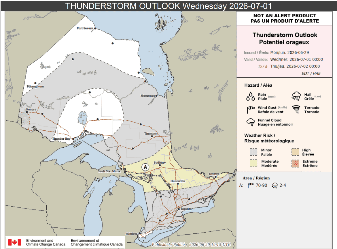
Wednesday
Come Wednesday, the threat of thunderstorms continues for many areas.
“An area of thunderstorms may track through the area on Wednesday from west to east,” forecasters said for location A on the outlook below.
“There remains large uncertainty for the development and timing of these storms. Large hail and strong wind gusts would be the main threats.”
Up to 40 mm of rain could fall locally.
Other areas highlighted in grey, which covers much of southern Ontario and parts of northern Ontario, could see isolated thunderstorms in the morning.
They could also redevelop in the afternoon and through the evening.
The storms could drop up to 30 mm of rain locally.
Maps via Environment Canada
INsauga's Editorial Standards and PoliciesPollView All
WIN A $100 GIFT CARD
Subscribe to INsauga’s daily email newsletter for a chance to win a $100 Amazon gift card.