
There is a risk of thunderstorms in parts of Ontario.
Environment Canada has issued outlooks which say that storms are possible in parts of the province on Tuesday and Wednesday.
Here’s a look at what’s expected:
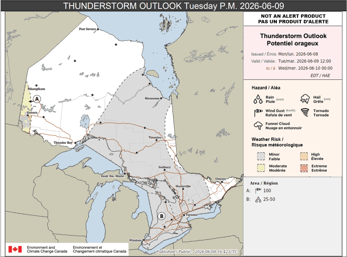
Tuesday p.m.
Portions of southwestern Ontario, labelled location B on the map below, could see heavy rain Tuesday afternoon and evening.
“Due to the expected humid air mass, thunderstorms will be capable of producing torrential downpours,” forecasters said for those areas.
Up to 50 mm of rain is possible locally, with a peak hourly amount of up to 30 mm. However, forecasters said rainfall amounts will vary depending on the area.
“Rainfall amounts will likely be highly variable across the region,” Environment Canada said.
“Due to the lack of recent rain, impacts are expected to be minimal, although urban and flood-prone areas may be affected.”
Other areas shaded in grey, particularly those in southern Ontario, including Toronto, could see scattered thunderstorms during the afternoon and evening.
Up to 30 mm of rain is possible locally.
Meanwhile, portions of northwestern Ontario near the Manitoba border (location A), may see more severe storms late Tuesday, or early Wednesday.
“A line of thunderstorms capable of damaging wind gusts is expected to cross the region Tuesday night,” forecasters said for those areas.
“Confidence is low regarding the timing of these thunderstorms. It is possible that the thunderstorms will only affect the region after midnight.”
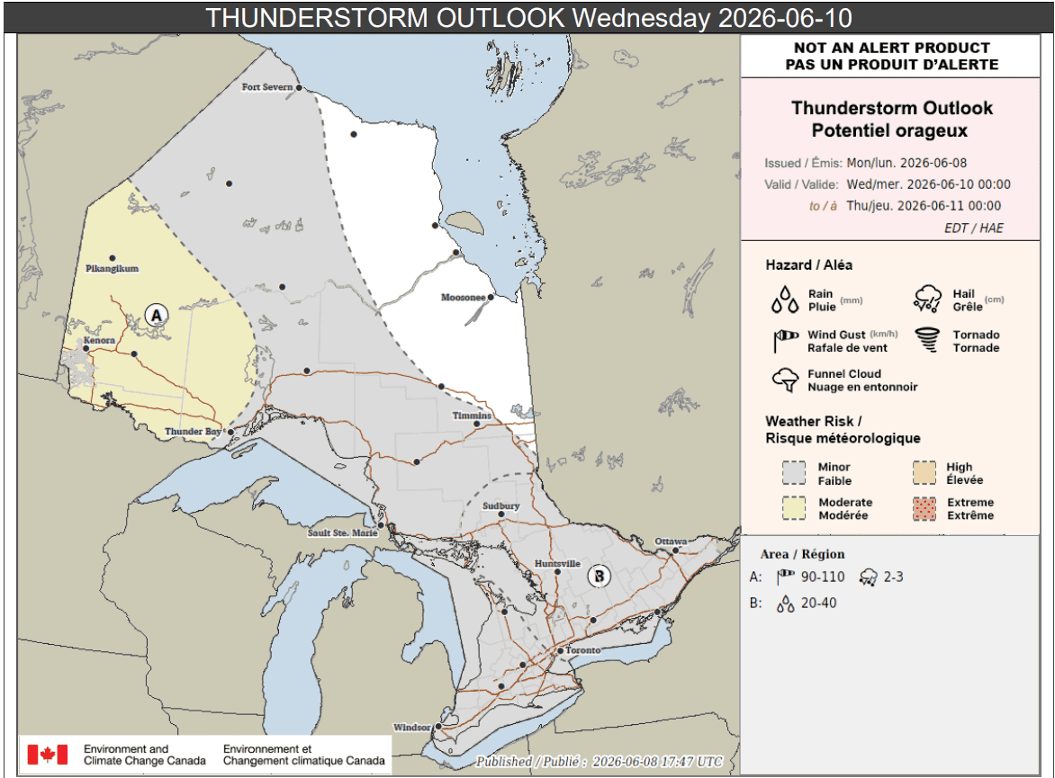
Wednesday
The risk of thunderstorms continues for a large part of the province on Wednesday.
In portions of southern and northeastern Ontario (location B on the map below), isolated storms are possible.
They could drop up to 40 mm of rain locally.
Other areas shaded in grey, which includes portions of southern and northern Ontario, could see isolated storms as well with up to 25 mm of rain.
Meanwhile, parts of northwestern Ontario could see severe storms.
“Thunderstorms are likely to move into Ontario late Tuesday night from Manitoba and continue into early Wednesday morning. These thunderstorms may have the potential to produce wind gusts up to 110 km/h and hail up to 3 cm in diameter,” forecasters said for those areas.
“Another round of thunderstorms is expected Wednesday afternoon into Wednesday evening. These thunderstorms may also produce damaging wind gusts up to 110 km/h and hail up to 3 cm in diameter.”
Rainfall amounts of 25 to 35 mm are possible.
Power outages may occur.
Maps via Environment Canada
INsauga's Editorial Standards and PoliciesPollView All
WIN A $100 GIFT CARD
Subscribe to INsauga’s daily email newsletter for a chance to win a $100 Amazon gift card.