
Thunderstorms with strong winds and hail could hit parts of southern Ontario later this week.
Environment Canada’s thunderstorm outlook for Thursday says storms may impact the region in the afternoon and evening.
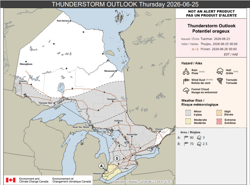
Portions of southwestern Ontario, including the Windsor area (location A on the map below), may see the strongest impacts.
“A few thunderstorms capable of producing wind gusts up to 90 km/h and hail up to 3 cm are possible,” forecasters said for those areas.
Loose objects could be tossed around and property damage may occur.
Up to 15 mm of rain is possible locally.
Location B on the map, which includes the Toronto area, Hamilton, and Niagara Region, among other locations, could see scattered thunderstorms.
They may produce wind gusts up to 70 km/h and hail up to 2.5 cm in size, forecasters said.
Further north, areas including Barrie, Huntsville, and Sudbury, as well as parts of eastern Ontario, may see isolated thunderstorms that bring less than 15 mm of rain locally.
And portions of northwestern and northeastern Ontario, as well as parts of the north shore of Lake Superior, are expected see storms too.
“Isolated slow-moving thunderstorms are likely, especially along lake breeze boundaries,” forecasters said.
Up to 30 mm of rain is possible locally there.
-
- Credit: Environment Canada

PollView All
WIN A $100 GIFT CARD
Subscribe to INsauga’s daily email newsletter for a chance to win a $100 Amazon gift card.