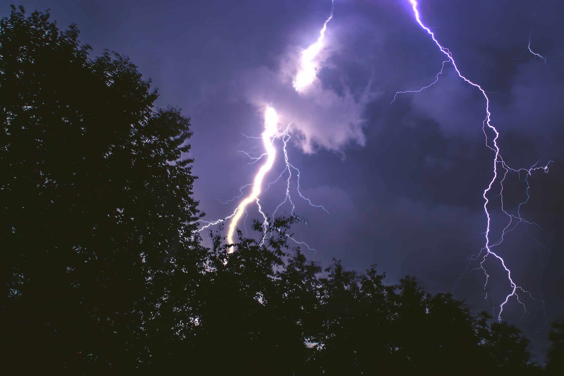
Parts of Ontario may see some active weather over the next couple of days.
Environment Canada has issued thunderstorm outlooks for Friday and Saturday.
Strong storms could hit southern Ontario on Saturday.
The weather agency also said some significant warmth is expected in northern Ontario on Sunday and Monday.
Here’s a look at what’s expected:
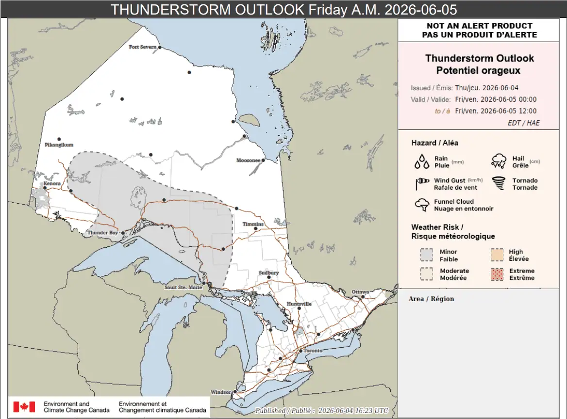
Friday a.m.
Overnight Thursday into Friday morning, portions of northern Ontario could see isolated thunderstorms.
Environment Canada said up to 25 mm of rain is possible locally, with a peak hourly amount of up to 20 mm.
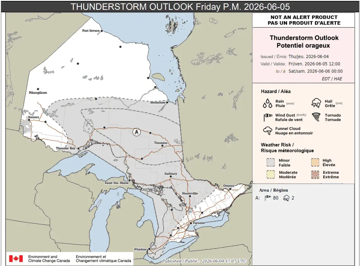
Friday p.m.
By Friday afternoon and evening, the threat of thunderstorms largely expands.
Places labelled area A on the map below, which includes Timmins, could see strong winds and hail.
“Scattered thunderstorms are possible, with the potential to produce wind gusts up to 80 km/h and hail up to 2 cm in diameter,” forecasters said.
Loose objects may be tossed and damage to plants and crops is possible.
Up to 35 mm of rain is possible locally there.
For other areas shaded in grey, which includes a huge portion of Ontario including Sudbury, Huntsville, and the western half of southern Ontario, isolated storms are possible in the afternoon and evening.
Environment Canada said up to 30 mm of rain is possible locally.
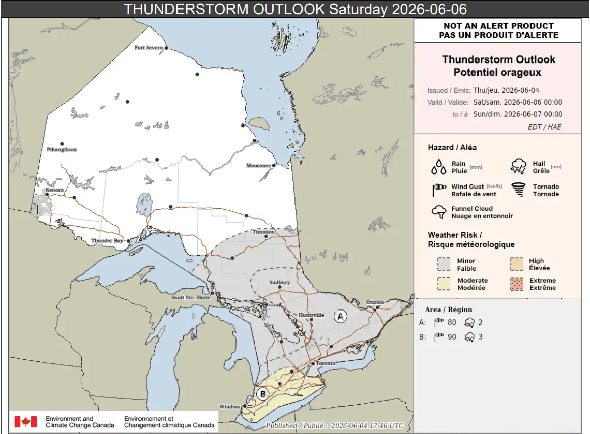
Saturday
Come Saturday, the most significant threat of thunderstorms appears to be in southern Ontario.
Portions of southwestern Ontario, including the Niagara Region, London, and Windsor (labelled location B highlighted in yellow on the map below), could see the worst of it.
“Thunderstorms are likely, with the potential to produce wind gusts up to 90 km/h and hail up to 3 cm in diameter,” forecasters said.
Those places could see local rainfall amounts of 25 to 35 mm, with a peak hourly rate of up to 30 mm.
Areas labelled location A could see scattered storms. That includes Toronto, Kingston, and Ottawa, north to Sudbury.
“Scattered thunderstorms are likely, with the potential to produce wind gusts up to 80 km/h and hail up to 2 cm in diameter,” Environment Canada said for those locations.
Up to 25 mm of rain could fall locally with a peak hourly amount of up to 20 mm.
Other areas shaded in grey, including the Bruce Peninsula, Sault Ste. Marie, and Timmins could see isolated storms with up to 25 mm locally.
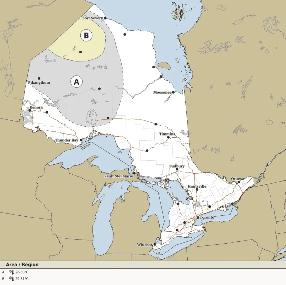
Sunday
On Sunday, heat in northern Ontario becomes the main story.
Portions of northwestern and far northwestern Ontario are expected to see high temperatures between 28 C and 30 C.
Lows near 17 C or 18 C are expected for areas highlighted in yellow, while areas in grey may see lows of 15 C to 17 C.
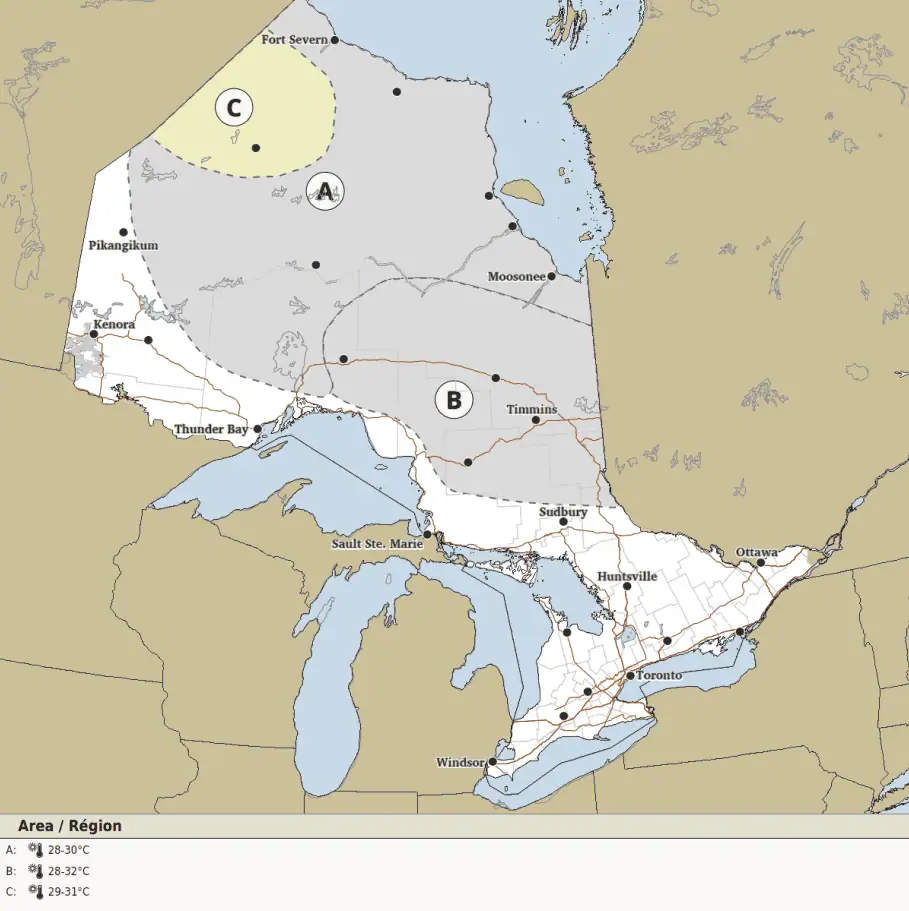
Monday
On Monday, areas in far northwestern Ontario (location C) are again expected to see highs between 28 C and 30 C, with lows between 17 C and 18 C.
Portions of northwestern and far northwestern Ontario (location A) could see similar highs, but lows of 15 C to 17 C.
And portions of northeastern Ontario and the north shore of Lake Superior (location B) could see highs of 29 C to 31 C, but lows might only be 15 C to 17 C.
Maps via Environment Canada
INsauga's Editorial Standards and PoliciesPollView All
WIN A $100 GIFT CARD
Subscribe to INsauga’s daily email newsletter for a chance to win a $100 Amazon gift card.