

Thunderstorms could bring heavy rain and gusty winds to southern Ontario on Thursday.
Overnight into Thursday morning, portions of southern Ontario and Manitoulin Island could see isolated thunderstorms that bring up to 30 mm of rain locally, Environment Canada said.
But it appears there is a larger threat in the afternoon and evening.
“Thunderstorms capable of torrential downpours and gusty winds are possible,” forecasters said for areas labelled location A on the map below.
That includes most of the region, including the Greater Toronto Area, Hamilton, Niagara, London, and Windsor.
“Heavy rainfall will likely have the highest impacts in urban areas and other areas of poor drainage,” Environment Canada said.
Flash flooding, water pooling on roads, and downed trees are all possible.
Location B on the map, which includes the Bruce Peninsula, Huntsville, and Ottawa, is also expected to see thunderstorms, though Environment Canada made no mention of gusty winds for those areas.
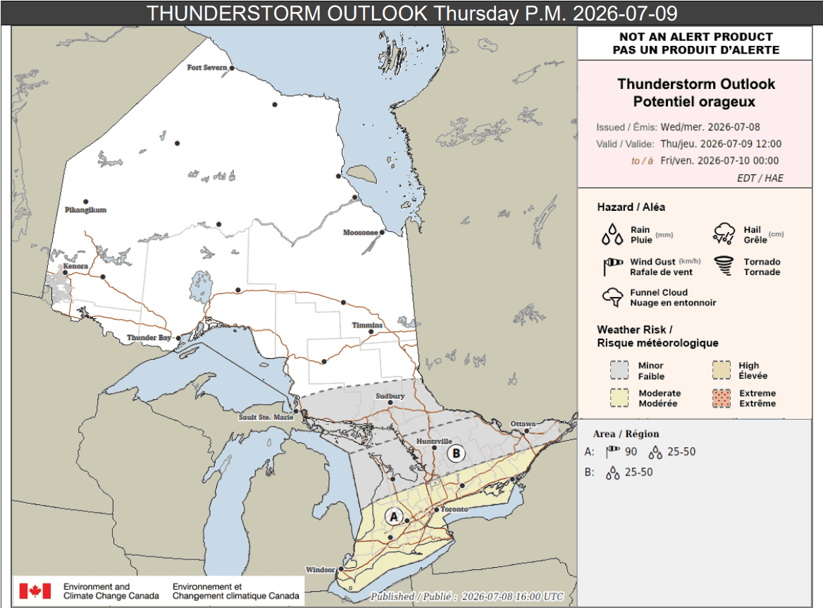
Up to 50 mm of rain is possible locally there as well.
And a bit further north, for areas highlighted in grey including Sudbury, isolated thunderstorms are possible on Thursday with up to 20 mm of rain.
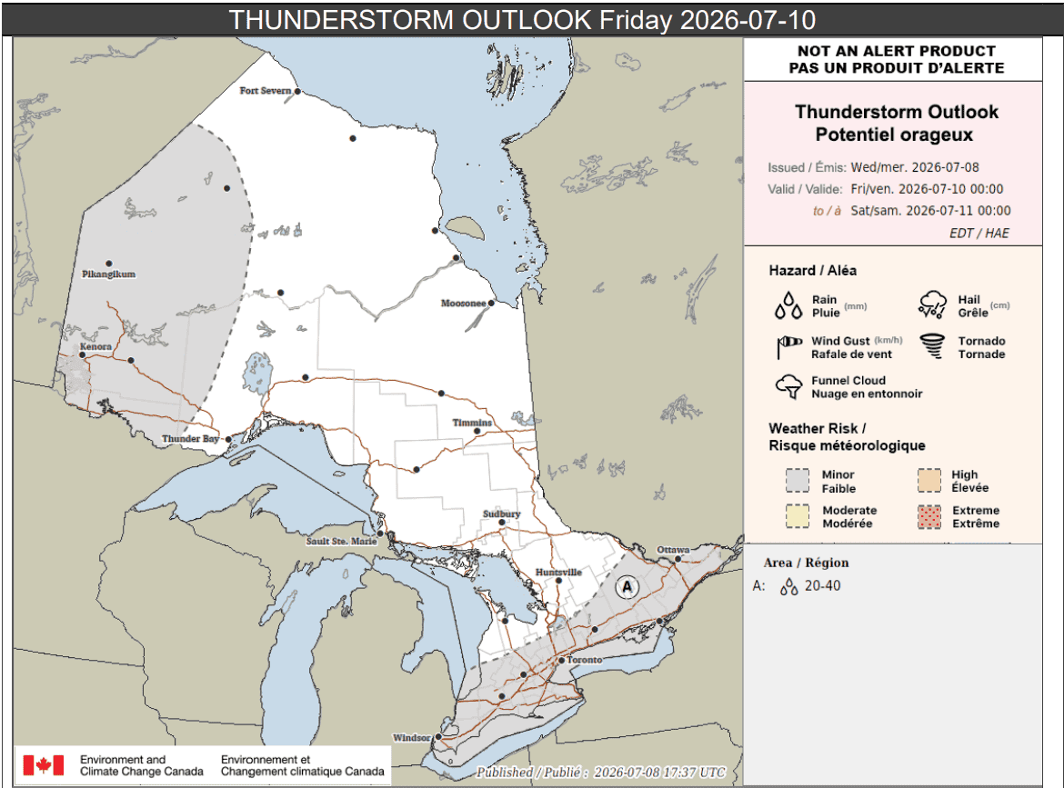
Thunderstorms are expected to continue into Friday morning for portions of southern Ontario with up to 40 mm of rain.
Northwestern Ontario, meanwhile, could see isolated or scattered thunderstorms Friday afternoon and evening.
PollView All
WIN A $100 GIFT CARD
Subscribe to INsauga’s daily email newsletter for a chance to win a $100 Amazon gift card.