
There could be some more active weather in southern Ontario.
Environment Canada has issued outlooks which say that thunderstorms could impact the region on Wednesday and Thursday.
Here’s a look at what is expected:
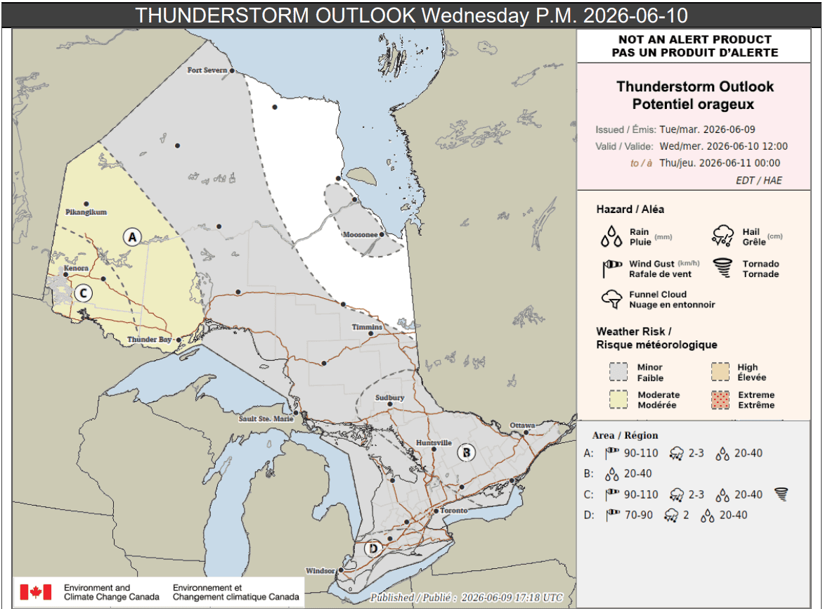
Wednesday p.m.
There’s a risk of isolated storms in the morning and that continues into the afternoon and evening.
For portions of southwestern Ontario, including London and Windsor (location D on the map below), storms could bring gusty winds and hail.
“Isolated thunderstorms may be capable of producing rainfall amounts up to 40 mm, hail up to 2 cm in diameter and wind gusts of 70 to 90 km/h,” forecasters said for those areas.
Power outages could occur.
READ MORE: Heat warning issued as humidex could reach 40 in part of southern Ontario
For other areas highlighted in grey, which includes portions of northern and southern Ontario, including the Greater Toronto Area, isolated thunderstorms are possible during the afternoon and evening.
Up to 25 mm of rain could fall locally.
Location B on the map, which includes Ottawa, Huntsville, and Sudbury, could see isolated storms with rainfall amounts of up to 40 mm.
Meanwhile, areas labelled locations A and C in northwestern Ontario are expected to see more severe storms.
“Thunderstorms are expected to develop in the afternoon and evening,” forecasters said for those places.
“Thunderstorms may have the potential to produce wind gusts up to 110 km/h, hail up to 3 cm in diameter and rainfall amounts up to 40 mm.”
Location C, including Kenora, has a risk of tornadoes.
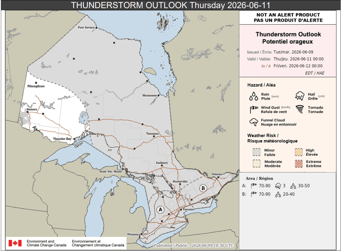
Thursday
On Thursday, thunderstorms may again occur in southern Ontario.
Portions of southwestern Ontario and the Greater Golden Horseshoe (location A below) could see strong storms with plenty of rain.
“Thunderstorms are expected Wednesday overnight into Thursday morning and may continue through the morning. Thunderstorms could redevelop in the evening,” forecasters said.
“Thunderstorms may have the potential to produce wind gusts up to 90 km/h, hail up to 3 cm in diameter and rainfall amounts up to 50 mm.”
Location B on the map, which includes Prince Edward County, Kingston, and Ottawa, is expected to see storms develop in the late morning and afternoon.
They could produce wind gusts of up to 90 km/h and up to 40 mm of rain locally.
The rest of the areas shaded in grey, including portions of central, northeastern, and far northern Ontario, could see isolated storms with up to 25 mm locally.
Maps via Environment Canada
INsauga's Editorial Standards and PoliciesPollView All
WIN A $100 GIFT CARD
Subscribe to INsauga’s daily email newsletter for a chance to win a $100 Amazon gift card.