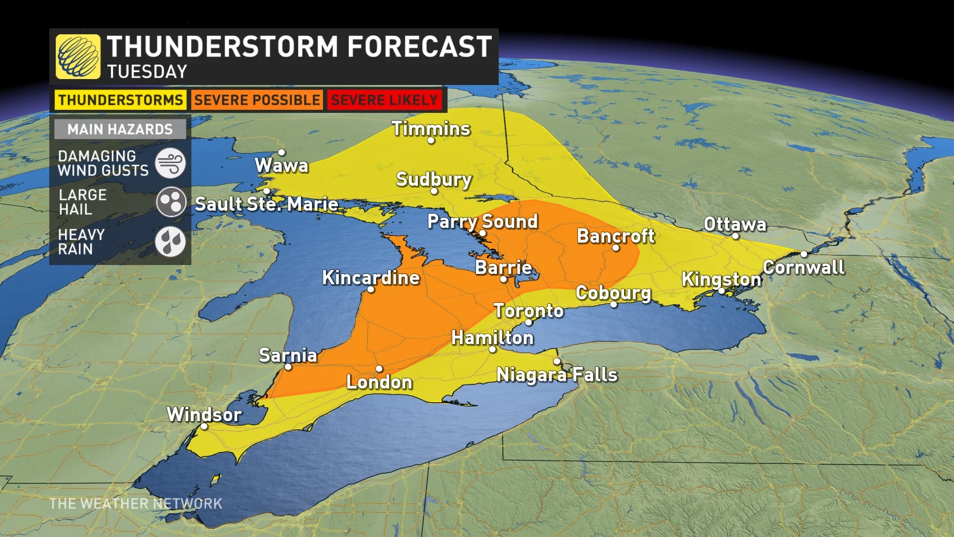
Sunshine and unseasonably warm temperatures may bring smiles to Ontario residents but it also creates some “unstable” weather patterns, setting the stage for severe thunderstorms to bubble up later Tuesday.
The GTA will likely be spared the full brunt of the storm – the main threat east will be from Parry Sound to Barrie and into southwestern Ontario – but areas of northern Durham Region, including Brock Township, could be in the path and the rain and thunderstorm risk will reach the rest of the GTA this evening, possibly impacting the late commute for some drivers.
Damaging winds, heavy rain, and large hail will be the main risks if storms develop as a cold front passes through the area and while the chances are low, the risk for rotating storms cannot be ruled out either.
Some areas could see heavy rainfall or downpours, increasing the risk for localized power outages before the system moves out of the province Tuesday night.
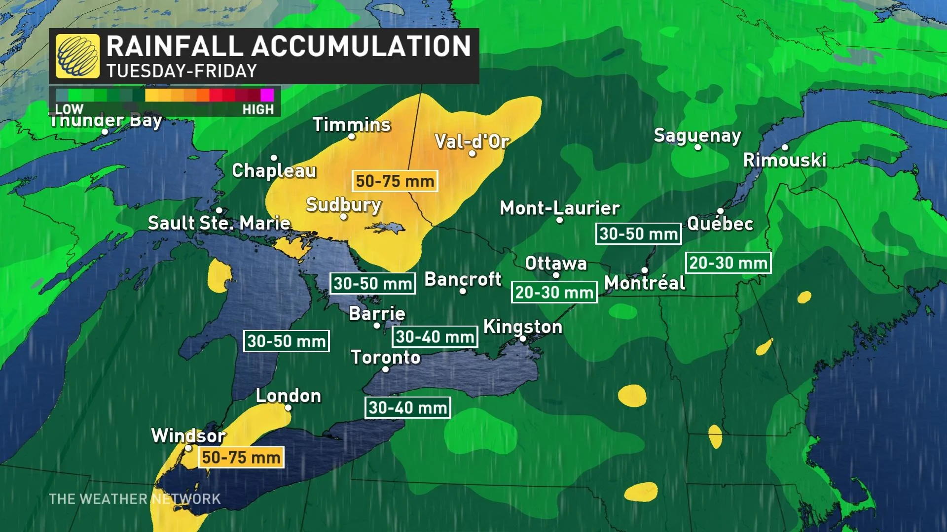
The rainy forecast doesn’t stop Tuesday, with a Texas Low brewing expected to make its way up to southern Ontario by Thursday morning, bringing soaking rains – as much as 40 mm – to the province through Friday.
This low-pressure system might also bring more thunderstorms, which could enhance rainfall intensity, bringing the risk for localized flooding to some of the hardest-hit areas.
PollView All
WIN A $100 GIFT CARD
Subscribe to INsauga’s daily email newsletter for a chance to win a $100 Amazon gift card.