
There is a risk of thunderstorms in southern Ontario as hot weather continues.
Weather outlooks have been issued by Environment Canada, highlighting a risk of storms over the next couple of days.
Here is a look at what’s expected:
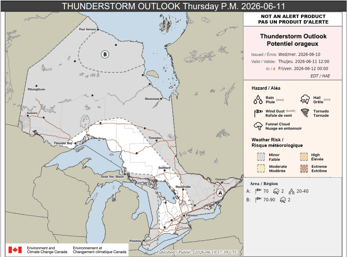
Thursday p.m.
Portions of eastern Ontario including Ottawa (location A on the thunderstorm outlook below), are expected to see scattered thunderstorms develop along and ahead of a cold front Thursday afternoon.
“Any storms may have the potential to produce up to 70 km/h wind gusts, up to 2 cm hail and heavy downpours with local rainfall amounts up 40 mm possible,” forecasters said for those areas.
Other portions of southern Ontario that are highlighted in grey, which includes Prince Edward County, Niagara Region, and Windsor, could see isolated thunderstorms Thursday afternoon and evening.
That same risk applies to much of northern Ontario.
Up to 25 mm of rain could fall locally.
Parts of far northern Ontario (location B on the map) could see thunderstorms with strong winds up to 90 km/h and hail in the afternoon as well.
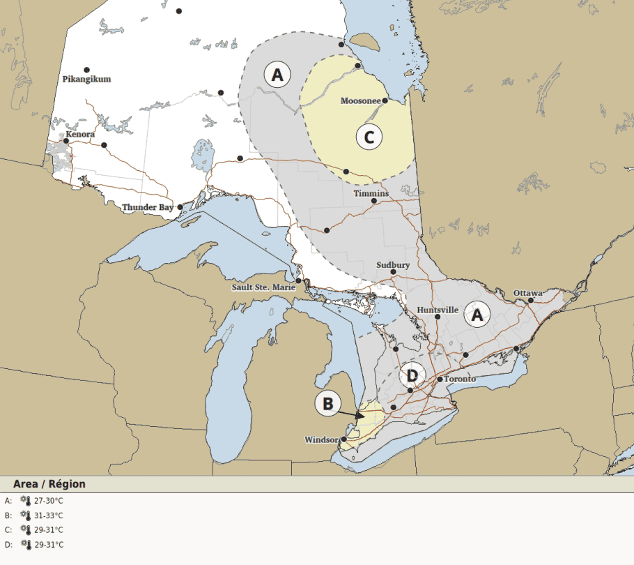
Meanwhile, hot weather continues in much of the province. Southern Ontario is expected to see highs ranging from 27 C to 33 C.
A heat warning remains in effect for parts of southwestern Ontario, including Windsor, where the humidex may reach 43.
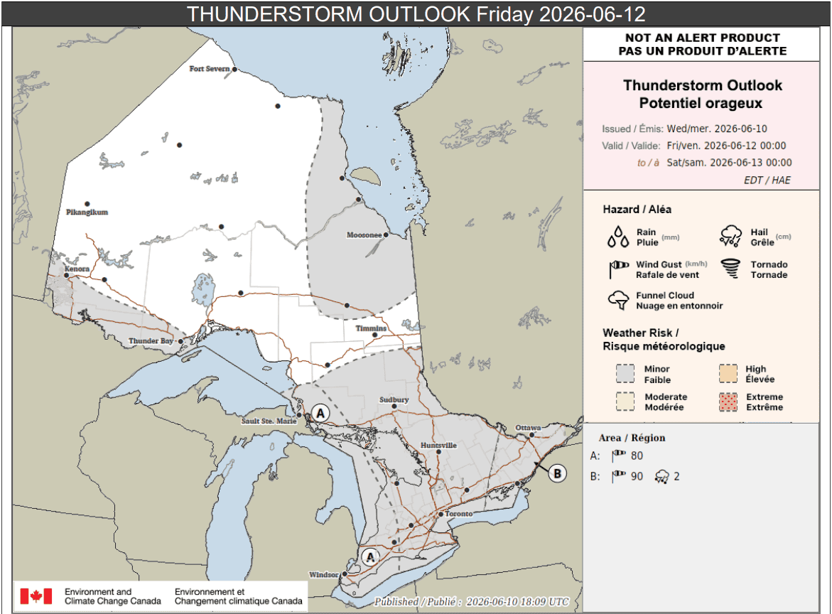
Friday
Parts of the province, including all of southern Ontario, has a risk of storms of Friday.
Areas labelled location A on the outlook below, which includes portions of southwestern Ontario and areas east of Lake Superior, are expected to see a line of thunderstorms move in from the United States in the early morning.
It may bring strong winds up to 80 km/h as well as up to 20 mm of rain locally.
Moving east, other areas including the Greater Toronto Area, Hamilton, Niagara Region, north to Barrie and cottage country, have a risk of isolated thunderstorms on Friday. that could drop up to 20 mm of rain locally.
Parts of northern Ontario could also see isolated storms.
In eastern Ontario (location B on the thunderstorm outlook), storms are expected to develop in the afternoon along a cold front. Winds up to 90 km/h and hail up to 2 cm are possible, forecasters said.
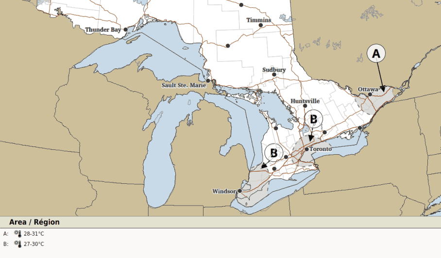
Warm weather will continue in the region, with highs of 27 C to 30 C in the Windsor and Toronto areas, and 28 C to 31 C in the Ottawa area.
Maps via Environment Canada
INsauga's Editorial Standards and PoliciesPollView All
WIN A $100 GIFT CARD
Subscribe to INsauga’s daily email newsletter for a chance to win a $100 Amazon gift card.