

As wildfire smoke continues to impact Ontario, parts of the province could see severe thunderstorms.
Environment Canada’s outlooks for Friday and Saturday show that smoke will continue to affect many areas, with some places also seeing a risk of storms.
Here’s a look at what is expected:
Friday p.m.
On Friday afternoon and evening, portions of northwestern Ontario including Thunder Bay (location A on the thunderstorm outlook below) could see strong storms.
“Severe thunderstorms are possible, producing wind gusts of 90 km/h and hail up to ping pong ball size,” forecasters said.
However, Environment Canada said wildfire smoke “could inhibit the development of thunderstorms over some areas.”
If storms do occur, they could drop up to 40 mm of rain locally.
Areas shaded in grey could also see active weather.
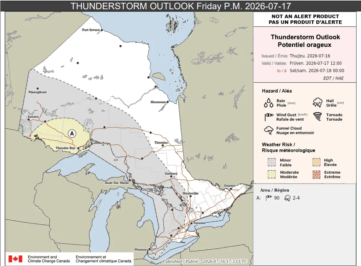
“Thunderstorms will move eastward across the province, reaching northeastern and southern Ontario by late evening,” Environment Canada said.
Again, up to 40 mm of rain could fall locally.
Meanwhile, wildfire smoke is expected to impact air quality in many areas on Friday.
Places shaded in orange on the significant weather outlook are expected to see “very high values of particulate matter at the surface,” while those in yellow will see “high values.”
-
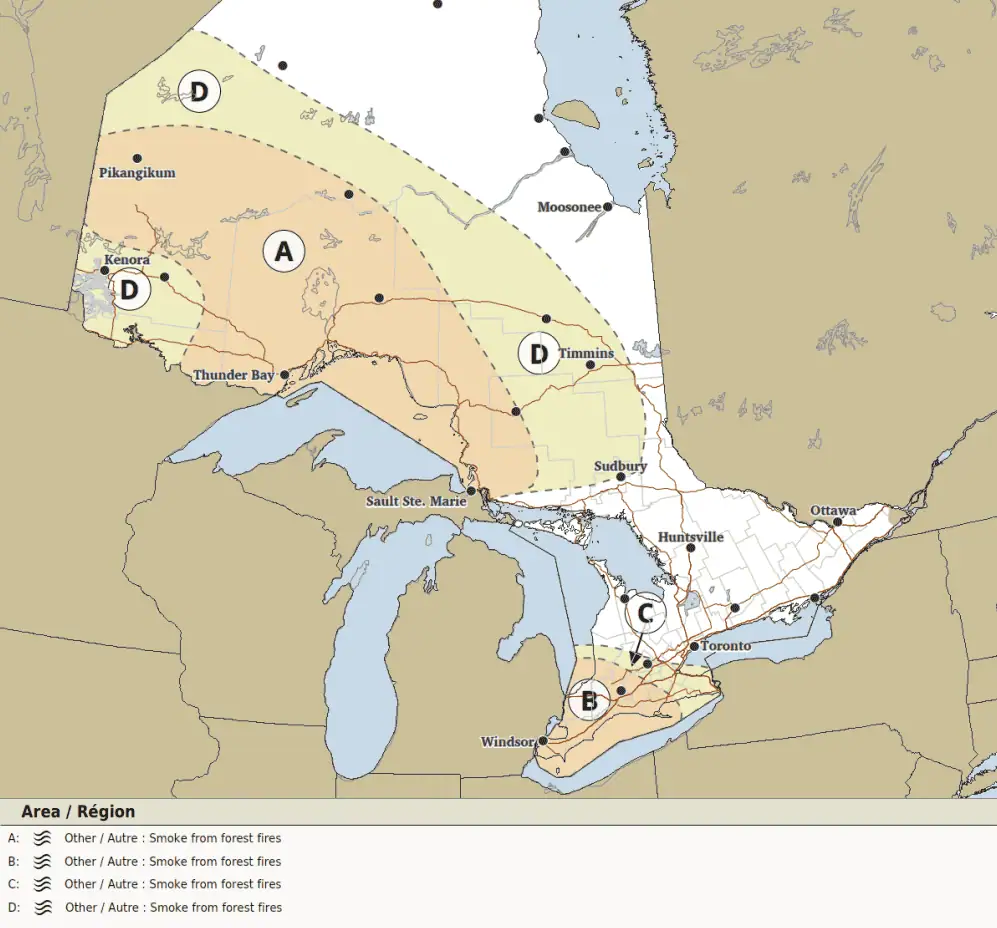
- Significant weather outlook for Friday.
Saturday
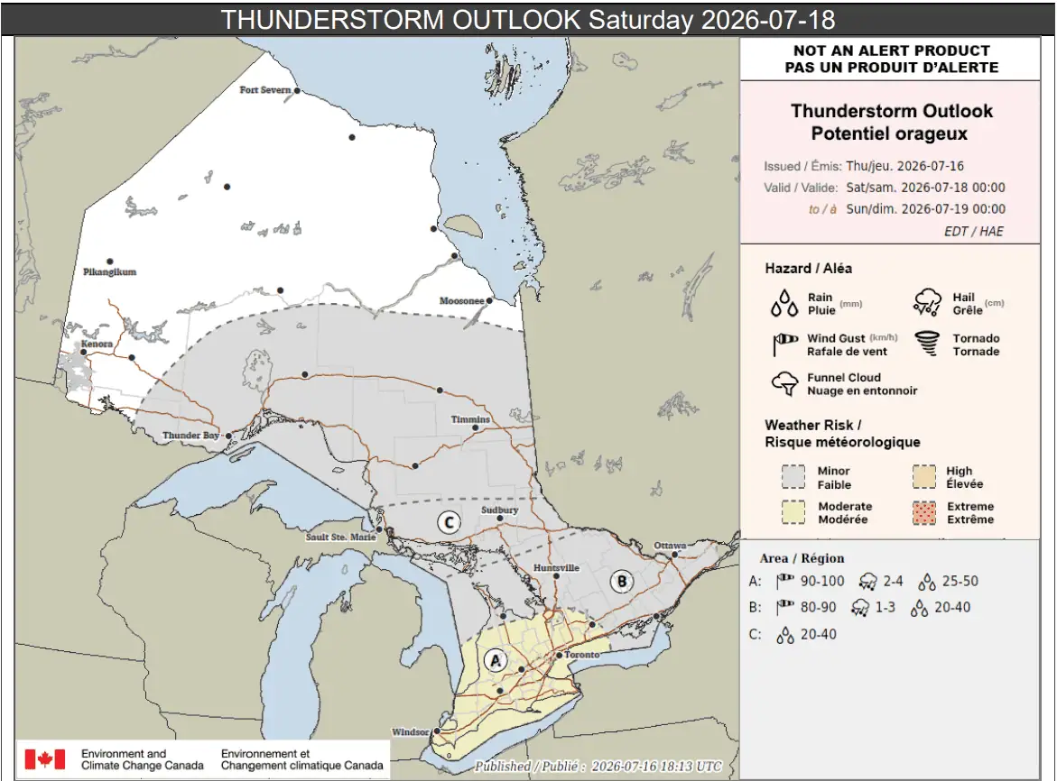
On Saturday, the biggest severe storm threat is for much of southern Ontario, including the Greater Toronto Area (location A on the thunderstorm outlook below).
“Severe thunderstorms are possible, producing wind gusts of near 100 km/h, hail of 2 to 4 cm, and heavy downpours,” forecasters said.
Up to 50 mm of rain could fall locally. Trees could be downed and power outages may occur.
However, wildfire smoke may inhibit the development of storms over some areas, Environment Canada said.
Location B, which includes the Bruce Peninsula, Huntsville, Prince Edward County, Kingston, and Ottawa, may also see storms.
“Severe thunderstorms are possible, producing wind gusts of near 90 km/h, hail of 1 to 3 cm, and heavy downpours,” Environment Canada said.
Up to 40 mm of rain could fall locally.
And location C, which includes Sault Ste. Marie and Sudbury, could see thunderstorms that produce heavy downpours with up to 25 mm of rain.
In each case, however, wildfire smoke could inhibit the development of storms.
Other areas shaded in grey have a risk of isolated thunderstorms.
Wildfire smoke is expected to continue to impact large parts of the province on Saturday and that could continue into Sunday.
Areas shaded in orange below are expected to see the worst of it, while those highlighted in yellow will also be impacted.
Thunderstorms could improve air quality in areas if they occur.
-
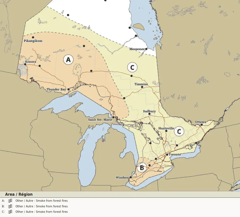
- Significant weather outlook for Saturday.
Maps via Environment Canada
INsauga's Editorial Standards and PoliciesPollView All
WIN A $100 GIFT CARD
Subscribe to INsauga’s daily email newsletter for a chance to win a $100 Amazon gift card.