The City of Mississauga is getting closer to its plan to have 22 speed cameras up and working across the city.
Mississauga officials launched the Automated Speed Enforcement (ASE) cameras program in 2021, starting with two cameras that rotated to various speeding hot spots in the city. The ASE cameras were first set up in Community Safety Zones in Malton and Erin Mills in early July 2021.
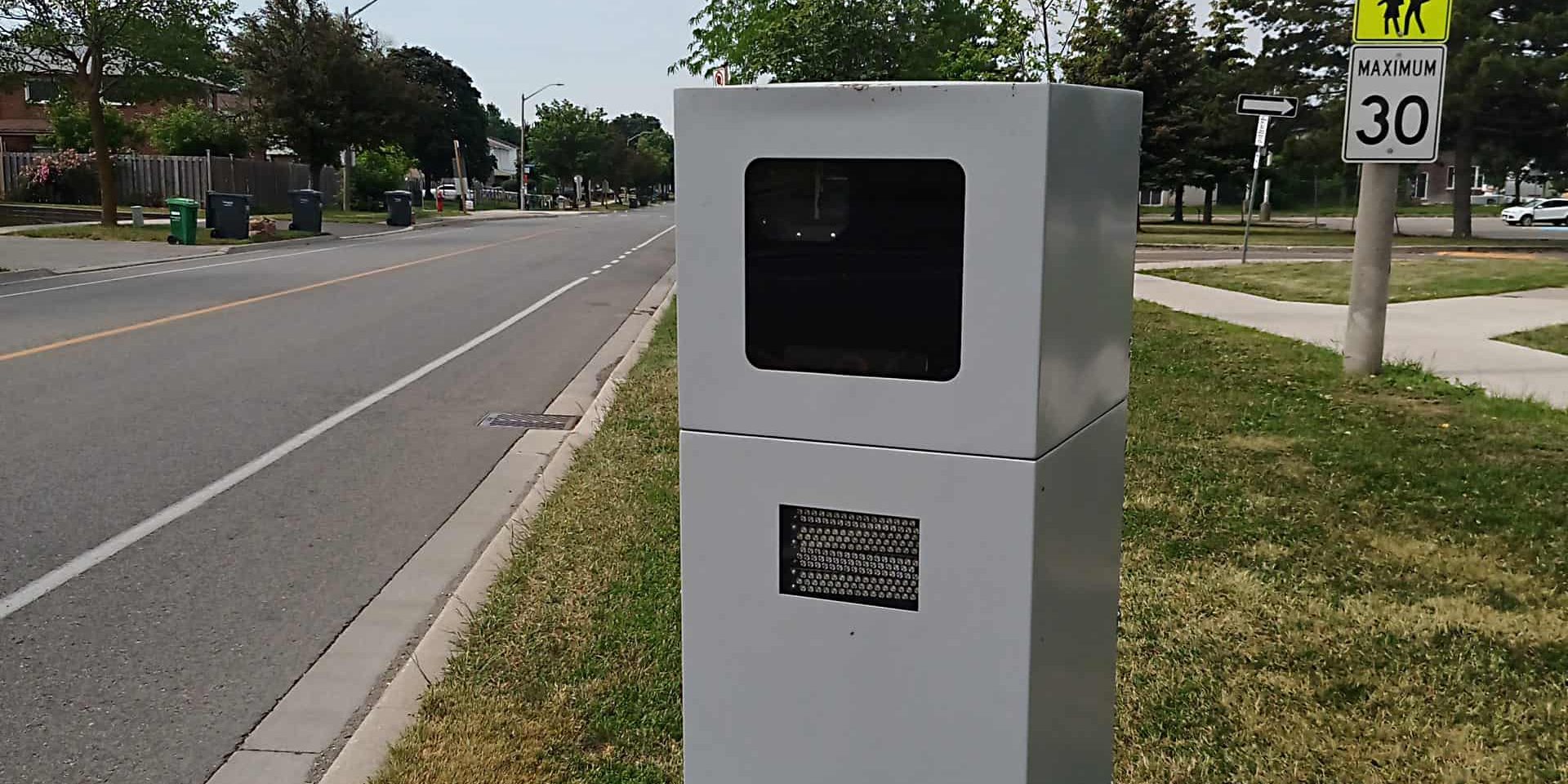
The photo radar cameras are meant to track and ticket speeders in Community Safety Zones near schools and speeding hot spots across the city. According to Ontario regulations, the cameras can only be installed in community safety zones where the speed limit is less than 80 km/h.
After the ASE captures an image of the vehicle exceeding the speed limit, the image is stored and sent to a processing centre. The image is reviewed by a provincial offences officer before a ticket is mailed to the registered plate owner. The speeding fine depends on the rate of speed over the limit.
The speed cameras are working to reduce speeds in and around school zones but a report this summer found they are also costing the city money due to issues collecting fines.
The cameras haven’t been popular with some drivers. In November this year, the city said there were 164 reports of vandalism to the cameras.
In January this year, there were only nine cameras up. As of today (Dec. 30), there are 18 cameras actively tracking speeders, and 23 future planned locations the City of Mississauga ASE map shows.
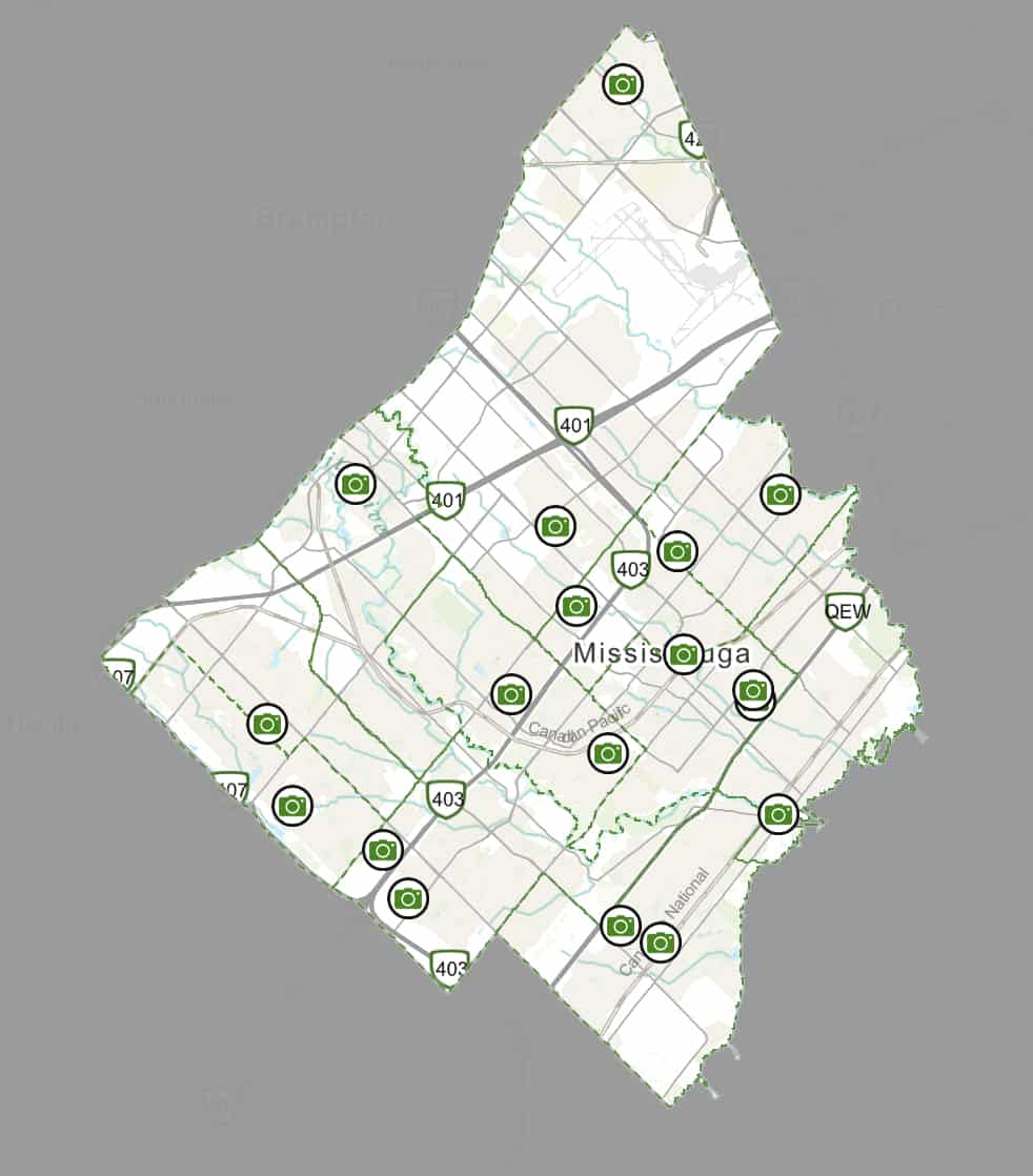
The City of Mississauga Automated Speed Enforcement map shows the active camera locations.
Here are the current locations (as of Dec. 30):
- Artesian Drive (between Auckland Avenue and Long Acre Drive) Active Sept. 20
- Churchill Meadows Boulevard (between Pearlstone Drive and Thomas Street) Active Sept. 1
- Clarkson Road North (between Birchwood Drive and Balsam Avenue) Active Sept. 1
- Cliff Road (between Queensway East and Tedwyn Drive) Active Oct. 5
- Colonial Drive (between Galbraith Drive and Thorcrest Drive) Active Aug. 12
- Front Street North (between Mississauga Road and Lakeshore Road) Active Sept. 20
- Gaslamp Walk (between John Watt Boulevard and Old Derry Road) Active Oct. 15
- McBride Avenue (between Erindale Station Road and Consort Crescent) Active Nov. 4
- Miller’s Grove (between Bartholomew Crescent and Tours Road) Active Nov. 8
- Mississauga Valley Boulevard (between Fairview Road and Trisha Downs) Active Nov. 4
- Morning Star Drive (between Goreway Drive and Darcel Avenue) Active Sept. 1
- Ponytrail Drive (between Fieldgate Drive and Silverplains Drive) Active April 6
- Willowbank Terrace (between Forets Fire Lane and Rathburn Road East) Active June 11
New in December:
- Barondale Drive (between Cortina Crescent and Wildwood Terrace) Active Dec. 9
- Corsair Road (between Pathinder Drive and Cherry Post Drive) Active Dec. 13
- Edenrose Street (between White Clover Way and Rathkeale Road) Active Dec. 9
- Kingsbridge Garden Circle (between Regents Terrance and Kingston Court) Active Dec. 9
- Robillard Road (between Christopher Road and Lenarthur Drive) Active Dec. 9
See the map here, and for more information, visit the City of Mississauga website.
INsauga's Editorial Standards and PoliciesPollView All
WIN A $100 GIFT CARD
Subscribe to INsauga’s daily email newsletter for a chance to win a $100 Amazon gift card.