
Here are the current Mississauga locations for photo radar
Published June 2, 2022 at 11:51 am
It’s not a secret where Mississauga places it photo radar cameras.
In fact, the City wants drivers to know so that they will slow down and stop speeding through neighbourhoods.
However, those who do speed and are caught on camera will face a fine based on how fast they are travelling.
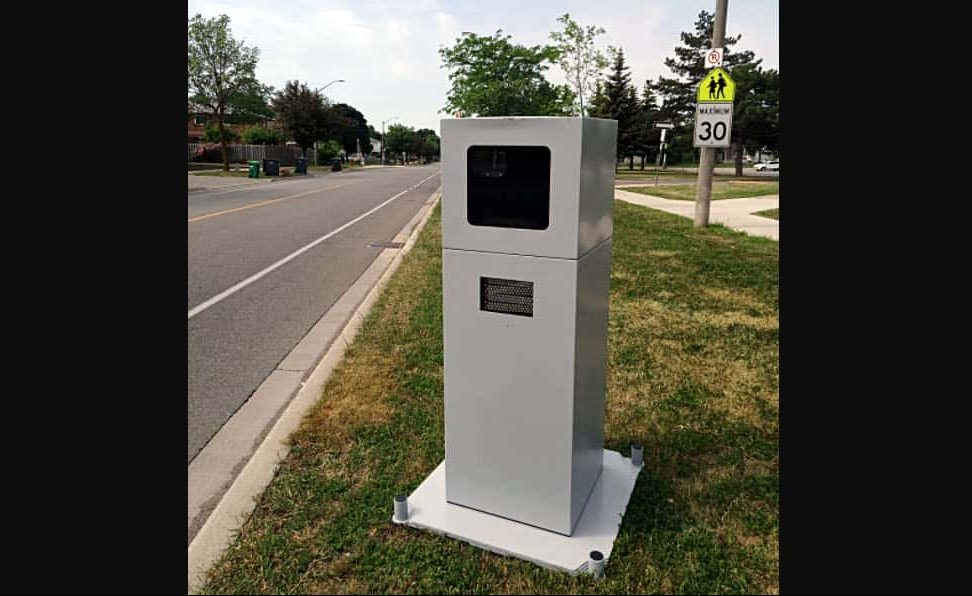
Officially known as automated speed enforcement (ASE), the device uses a camera and speed measurement equipment to enforce the speed limit. When a vehicle is detected travelling above the posted speed limit, a ticket is issued to the registered owner of the vehicle.
Here are the current ASE locations:
- Ceremonial Dr. (between Chagall Ct. and Bristol Rd W.)
- Cliff Rd. (between Rudar Rd. and Abruz Blvd.)
- Copenhagen Rd. (between Bendigo Ct. and Tamar Rd.)
- Forest Dr. (between Derry Rd. and Juneberry Rd.)
- Garthwood Rd. (Colonial Dr. to Clayton Rd.)
- Gooderham Estate Blvd. (Old Derry Rd. to Silverthorn Mill Ave.)
- Lewisham Dr. (between Fontwell Cres. and Truscott Dr.)
- Melton Dr. (between Stir Cr. to Rambo Rd.)
- Ponytrail Dr. (between Fieldgate Dr. and Silverplains Dr.)
- Queesnston Dr. (between Ashcroft Cres. and Fellmore Dr.)
- Runningbrook Dr. (between Autumn Harvest Dr. and Riverspray Cres.)
- Shrwood Mills Blvd. (between Brockworth Dr. and Fallingbrook Dr.)
- Silver Creek Blvd. (between Mississauga Valley Blvd. and Gwendale Cres.)
- Swinburne Dr. (between Bancroft Dr. and Douguy Blvd.)
- Terragar Blvd. (between Rosehurst Dr. and Black Walnut Tr.)
- Thorncrest Dr. (Colonial Dr. to Loyalist Dr.)
Videos


