
Hamilton group’s mapping of underutilized space turns up quite a coincidence
Published December 3, 2021 at 5:50 pm
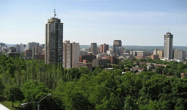
There is some strong confirmation that Hamilton has a lot of underutilized space for infill housing development.
This week, the website Downtown Sparrow, which is a resource curated by community organizers in the lower city, released a volunteer-created map showing areas that could accommodate a net gain in housing. While the calculations were made over several months by volunteers who received guidance and training, they found there about 1,347 hectares (3,328 acres) of potential space.
Two weeks ago, Hamilton city council overwhelmingly rejected a staff recommendation to expand the urban boundary by about 1,340 hectares (3,300 acres).
We're thrilled to announce the completion of our map of underutilized space within the existing urban boundary, a labour of volunteer love for more than 6 months, in partnership with Stop Sprawl HamOnt. #HamOnt @Gasp4Change https://t.co/lec1c4b2IV
— Downtown Sparrow (@DowntownSparrow) December 2, 2021
“The purpose of the project is to illustrate how much land might be available for gentle density and infill projects within the current urban boundary,” an explainer attached to a detailed map reads.
“A mix of uses are possible given the context of the map and the planning horizon for growth that’s projected over a 30 year period (to 2051). We recognize that the City of Hamilton’s official plan and some of its current zoning would need to be altered to accommodate this vision.”
Videos


Downtown Sparrow’s map is broken down to show employment lands that would need to be rezoned, and land that might be zoned as mixed use, residential, commercial, vacant, open space.
The map was made by a group of nine volunteers, led by a project manager, one-time Ward 2 councillor candidate Cameron Kroetsch, and technical lead Zoe Green.
This would not have been possible without volunteers @C_Ballarano, @ZoeGreenCDN, Laura Katz, @CameronKroetsch, Kathleen Livingstone, @frances_twitr, @keyboardmoron, Esme Tondreau, and @jatonini. And many thanks for the guidance from @EnvHamilton's Dr. Lynda Lukasik!
— Downtown Sparrow (@DowntownSparrow) December 2, 2021
Hamilton is grappling with an affordable housing crisis, with some of the highest home prices in North America relative to income and years-long waits for supportive housing units. Downtown Sparrow emphasized that this map is not meant to be definitive, but is intended to spur conversation about what type of housing should be built in the city.
“We recognize that much of this land is owned privately and that both incentives and disincentives would need to be proposed by the City over the next 30 years in order for these lands to be put to their highest and best use,” the site acknowledges.
It adds, “The volunteers who did the majority of the mapping for this grassroots project were neither planning professionals nor GIS experts. This map is meant to represent the best efforts of those volunteers. There may be some variability in both interpretation and execution.”
City council voted 13-3 for no urban boundary expansion on Nov. 19.
Mayor Fred Eisenberger, and councillors Brad Clark (Ward 9), John-Paul Danko (8), Jason Farr (2), Tom Jackson (6), Brenda Johnson (11), Sam Merulla (4), Nrinder Nann (3), Judi Partridge (15), Esther Pauls (7), Russ Powers (5), Arlene VanderBeek (13) and Maureen Wilson (1) voted for no urban boundary expansion.
Ward 10 Coun. Maria Pearson, along with Lloyd Ferguson (12) and Terry Whitehead (14), favoured the expansion.
insauga's Editorial Standards and Policies advertising